
The 2010 Flank Eruption and Kahinga Kabarinzi
A fissure approximately 600 metres long opened on the south-southeastern flank roughly 1.5 km from the caldera rim; the Goma Volcano Observatory placed the resulting new cone approximately 3.2 km from the summit, at around 1.437°S, 29.211°E. Fountaining spatter piled around the lower end of that fissure into a cone reported at about 150 metres above the surrounding terrain which GVO reporting named Kahinga Kabarinzi. Two large lava branches extended south and southwest, broadly retracing portions of the 2006 flow paths. Field reconstruction by Smets and colleagues, published in 2014, places the main flow lengths at approximately 10.5 to 11 kilometres. A helicopter overflight on 27 January recorded only fumarolic activity, marking the close of the main effusive phase.
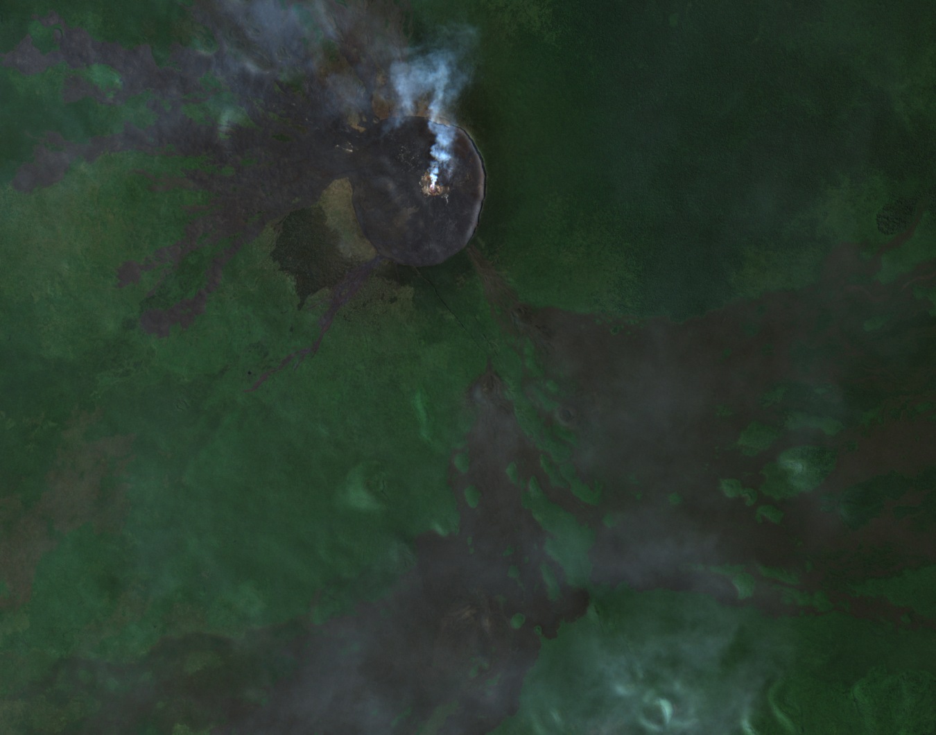
The southeastern vent field carries earlier eruptive history as well. A cone from the 2000 event lies just east of the 2010 Kahinga Kabarinzi cone, and a mapped lava field from 2001 radiates east along the slope into the same general area. Elisabet M. Head, Ann L. Maclean, and Simon A. Carn traced Nyamuragira lava flows from 1967 through 2011 using Landsat and ALI imagery, using contrasts between flows and recovering vegetation to distinguish where new lava covered older flows. The 2026 Sentinel-2 scene of the region shows the summit caldera, an active plume, and the dark textures of multiple past flow generations together on the same slope.
Precursor Signals and Field Monitoring
Analysis by Smets and colleagues identified four stages of lava discharge during the January 2010 eruption. A deformation signal traceable in radar data appeared approximately three weeks before the event, accompanied by modest changes in short-period seismicity and SO2 output. Short-term tremor and long-period seismic signals were detected less than two hours before eruption onset. The European Space Agency contributed field support through Radarsat-2 and Envisat, with an interferogram comparing scenes from 7 December 2009 and 8 January 2010 that helped isolate the active edifice and confirmed that the eruption was on Nyamuragira. At the time, residents and officials had also been concerned about nearby Nyiragongo.
Shield Structure and Flank Behavior
Nyamuragira rises as a wide shield north of Lake Kivu, its long, low-gradient flanks allowing lava to travel considerable distances from the summit. In January 2010, lava emerged inside the caldera and along a separate flank fissure during the same eruption. The southeastern slope, has accumulated overlapping fields of lava during repeated eruptions.