
Zöller's 1891 Panorama and the Naming of Herbert-Berg
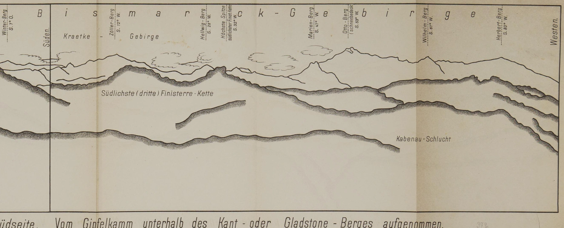
The south-facing folded panorama published in Zöller's 1891 book Deutsch-Neuguinea und meine Ersteigung des Finisterre-Gebirges shows "Herbert-Berg" labelled toward the right of the frame at a recorded bearing of S 80° W, with "Wilhelm-Berg" to its left at S 67° W. The panorama was drawn from a ridge vantage point below a peak Zöller called Kant/Gladstone; the image reproduced by the Staats- und Universitätsbibliothek Bremen is catalogued under Public Domain Mark 1.0.
According to University of Adelaide historical research, Zöller named the peak after Herbert von Bismarck, the elder son of Chancellor Otto von Bismarck. The range itself carries the chancellor's surname. Both names became part of the German colonial maps of the interior.
The 1888 Expedition into the Finisterre Range
A contemporary account published in the Geographischer Monatsbericht in 1889, citing the January 17 Cologne paper, records that Zöller led an inland approach from Constantinahafen in November 1888 with three officers, reaching approximately 2,750 m in the Finisterre Range. That expedition established the viewpoint from which the panorama was later composed. The group saw the more distant Bismarck Range across the ridges they had been exploring.
Reported Elevations and Botanical Documentation
Three elevation figures appear in the sources without resolving to a single surveyed value. P. van Royen's 1980 Alpine Flora of New Guinea lists Mount Herbert at 4,160 m in its mountain register and gives approximately 4,200 m in the caption to plate 60. The University of Adelaide historical research cites 4,267 m.
Plate 60 of van Royen's Alpine Flora, photographed by J. M. B. Smith, shows Mount Herbert as seen looking northwest from Imbuka Ridge on Mount Wilhelm, taken from about 3,650 m. The image identifies Nothofagus and conifer forest on the middle ridge and Dacrycarpus compactus in the foreground. The 1986 IUCN plant-sites inventory explicitly included Mount Herbert within the wider Mount Wilhelm botanical area.