
Geology and Landform Development
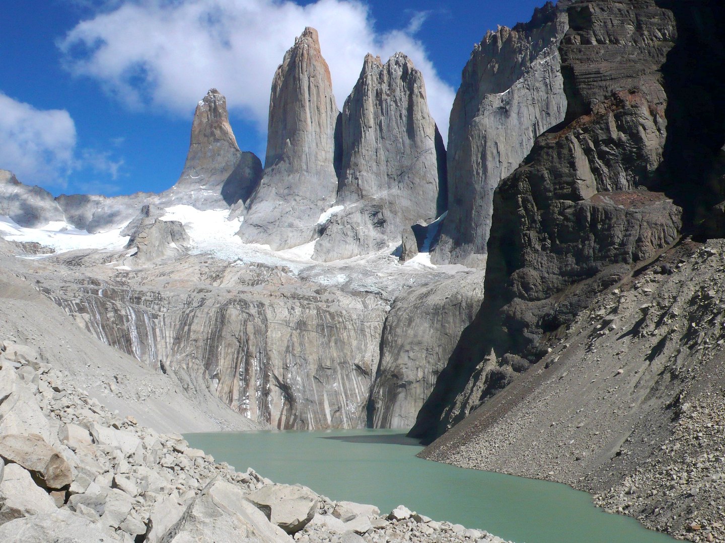
The Paine range is not a conventional extension of the Patagonian Andes; rather, CONAF identifies it as a distinct formation within that larger chain. Its internal structure reveals two superimposed rock types: sedimentary rock in the upper zones and granite at the base, an arrangement that glacial erosion sculpted over millennia. The three towers that give the group its name — the granite pillars rising abruptly above the Río Ascencio valley — are the most recognized expression of that process, but the formations known as the Cuernos del Paine and Cerro Paine Grande are equally defining elements of the massif, each with its own morphology and its own erosional history.
The valleys, moraines, and lakes distributed across the massif are direct evidence of the glaciation that carved this landscape. The Southern Patagonian Ice Field feeds the glaciers of the group, among them Glacier Grey, whose front calves icebergs into the lake of the same name. This connection between the active continental ice and the resulting topography makes the Paine massif a living record of glacial dynamics.
Ecology and Altitudinal Transitions
The massif articulates a sequence of vegetation zones determined by altitude and exposure to wind. In the lower sectors, Magellanic forest predominates, characterized by lenga — Nothofagus pumilio — alongside other deciduous species adapted to the austral climate. As elevation increases, tree cover opens and gives way to increasingly sparse high-altitude vegetation. Along the eastern edges of the park, this forest vegetation transitions to the Patagonian steppe, an open ecosystem dominated by grasses and low shrubs subject to the constant westerly wind.
Among the fauna documented by CONAF in the area, notable species include the guanaco — Lama guanicoe —, a wild ungulate native to Patagonia, and the Andean condor — Vultur gryphus —, which exploits the thermal currents generated by the massif's rock walls. The coexistence of these ecosystems across a relatively pronounced altitudinal gradient partly explains the significance that UNESCO's Man and the Biosphere Programme assigned to this area in 1978, when it was recognized as a biosphere reserve — a distinction related to the conservation of representative ecosystems and not to World Heritage status.
Institutional History and Legal Protection
The formal protection of the area has a precise origin in Chilean administrative history. In 1959, a government decree created the Parque Nacional de Turismo Lago Grey, a designation that recognized the glacial lake as the central feature of the protected territory. Three years later, Decree 1050, published on January 18, 1962, in the Diario Oficial, changed the name to Parque Nacional de Turismo Torres del Paine, a designation that over time became consolidated as Parque Nacional Torres del Paine, shifting the nominal focus from the lake to the granite towers that already identified the mountain group.
Administration of the park falls to the Corporación Nacional Forestal, CONAF, the body that manages Chile's state-protected wilderness areas.
The Paine Massif in the Patagonian Context
The Magallanes region of Patagonia provides the geographical framework in which the Paine massif acquires its specific character. To the east of the park stretches the steppe of Atlantic influence; to the west, the continental ice and Pacific-side fjords form a landscape of difficult access. The Paine massif occupies a pivotal position between both worlds.
The expeditions that began to frequent the group in the mid-twentieth century helped establish the cartography in use today. The three Torres — Torre Sur, Torre Central, and Torre Norte — give the group its name; the Cuernos del Paine, with their characteristic alternation of granite and dark sedimentary rock, form the central sector of the massif; and Paine Grande, the highest summit in the group, closes off the western end.