
Place Name and Early Survey Record
H. Adams Carter's 1975 analysis in the American Alpine Journal parses the Balti compound as serpo (yellow) and laggo (pass), and his table lists both Sarpo Laggo and Serpo Laggo as paired transliteration forms. Field reports and maps apply the name Sarpo Laggo to a pass, a glacier, and a peak in the same drainage.
The 1929 Italian expedition carried out survey and glacial reconnaissance work in the Sarpo Laggo drainage, documented in the Himalayan Journal. Eric Shipton's 1937 Shaksgam expedition approached the Sarpo Laggo Glacier from the Trango side, with topographer Michael Spender extending the survey network; their account and maps contributed to the regional picture of the passes and tributary glaciers. Ardito Desio's 1954 Italian expedition, also reported in the Himalayan Journal, described survey work connecting the Younghusband and Moni icefield areas as part of the broader K2 expedition's geographic work. None of these earlier efforts included a documented summit ascent of Sarpo Laggo Peak.
The 2012 Southeast Ridge Ascent
In May 2012, Austrian climber Lisi Steurer joined Aymeric Clouet, Christian Trommsdorff, and Patrick Wagnon, approaching the peak from above Trango. The team left base camp on 28 May and returned on 31 May. Their published account in the 2013 American Alpine Journal describes reaching the 6,208 m eastern summit by the southeast ridge after a twelve-hour climb in deep snow, with a bivouac just below the summit cornice.
The American Alpine Journal editor who published the 2013 report stated that no earlier ascent of the peak appeared in the record available to them. That account treats crossing Sarpo Laggo Pass at 5,704 m and climbing the summit ridge as separate undertakings divided by roughly 500 m of elevation and different terrain. Club Alpino Italiano published photographs by Odina Grosso Roviera and other members of her party in Montagne360 in June 2020, with images of the glacier, pass, and peak.
Glacier Surges in the Sarpo Laggo Basin
The Sarpo Laggo glacier basin and its tributaries have been the subject of satellite-based surge observations distinct from any summit measurement. Frank Paul's 2022 paper in The Cryosphere documents a large surge in the main Sarpo Laggo glacier before 1960 and a smaller surge around 1993–95 confined to a higher section of the glacier. Surges are periods of anomalously fast glacier flow, detectable in sequences of satellite or aerial imagery, and are a recognized behavior of several Karakoram glaciers.
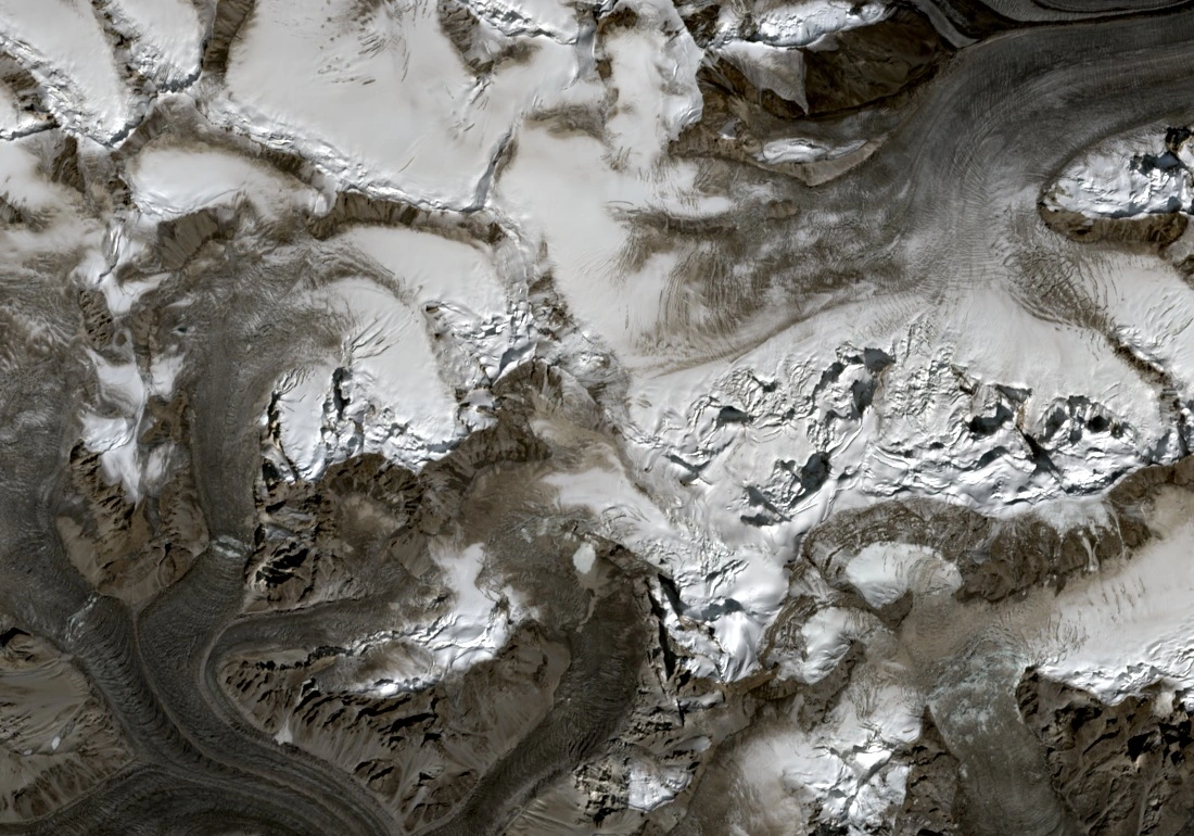
Frank Paul's 2022 study documents the South Chongtar Glacier advancing roughly 3 km over ten months from July 2020, pushing against the adjoining ice of the main Sarpo Laggo Glacier. A September 2025 Sentinel-2 true-colour image shows both summits and their adjoining glaciated passes within the broader massif.
Topographic Position and Map Sources
The eastern summit point in this guide follows the position labelled on Seyfferth's central Karakoram map, cross-checked against a distinct local high point in the 30 m Copernicus GLO-30 surface model. The 2012 ascent account reports 6,208 m for the summit, and Matthias Kuhle's 1997 field photographs, annotated in his glaciology publication, cite a massif elevation of 6,225 m. Both individual summits retain Seyfferth's reported figures of 6,208 m and 6,211 m.
Seyfferth's map labels the eastern summit at 6,208 m and the western summit at 6,211 m, while a separate existing listing records 7,373 m at a point nearly 20 km to the northeast where the Copernicus 30 m surface model reads approximately 5,292 m. The mapped and climbed summit positions supply the corrected figures used in this guide.