
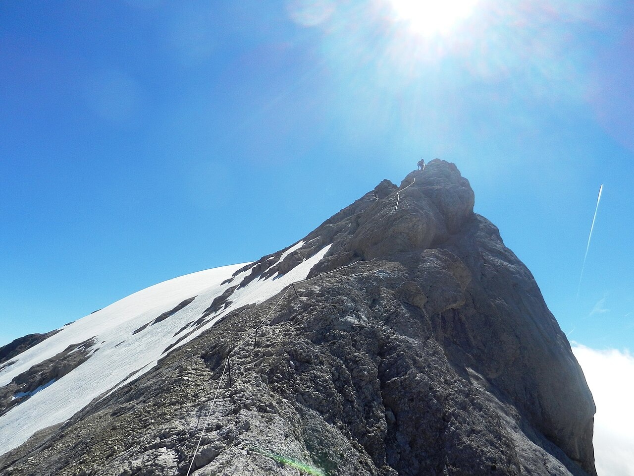
A Ridge of Triassic Limestone Above Two Faces
The Marmolada massif is documented by the Dolomites UNESCO Foundation as a carbonate platform formed from Triassic limestone, the pale rock type that defines the Dolomites at the scale of the range. The Cresta Ovest runs along the upper margin of that platform, where the ridge's southern crags drop away steeply and the north side retains glacial ice. A photograph taken on the ridge in August 2013 by Maurizio Ceol records exactly this juxtaposition — bare rock and adjacent ice — along the crest itself.
The SAT (Società degli Alpinisti Tridentini) survey identifies the connecting approach as trail E606, running from Rifugio Contrin through Forcella Marmolada to the Fedaia end at Capanna Cima 11. This path through the col is a distinct line from the via ferrata that ascends the ridge above, the two routes diverging at the lower Forcella where the col levels out before the steeper rock begins.
From Exploratory Climb to Named Wire Route
In 1898 members of the Nuremberg section of the German and Austrian Alpine Club, including Hans Seyffert and Dittmann with guide Luigi Rizzi, explored the west crest. The club's 1899 journal carries a first-hand account of a second descent of the ridge, dated 1 September 1898, in which one climber describes fresh snow, icing, and repeated attempts to hold the exact line of the crest. The Nuremberg section's 1903 programme scheduled a ceremony for 5 August of that year to mark the formal opening of a new equipped way along the ridge under the section's name. By the time the club's 1904 annual report was published, the west ridge had been made accessible and a traverse continuing through Val Contrin to Fedaia was noted as a consequence.
Club records from 1914 describe a tribute held on 26 August at the Contrin hut following the renaming of the route as Hans-Seyffert-Weg in honour of the 1898 climber. A centenary history published by the Nuremberg section in 1969 credits 1913 as the year of the naming and records the physical fittings on the ridge, among them wire ropes, a ladder, and steel staples. The 1903 opening programme and the sequence of early twentieth-century names and hardware together document how an exploratory climb became a marked and equipped mountain route.
Route Management After the 2022 Glacier Collapse
On 3 July 2022 a serac collapse occurred on the northern glacier of the Marmolada, triggering restrictions on several routes in the area, including the Cresta Ovest via ferrata. The Autonomous Province of Trento issued a notice dated 22 August 2022 recording the limited reopening of the west ridge, specifically via the Val Contrin approach. That notice also documents physical works carried out at that time to create passing points for climbers moving in opposite directions on the route.
The 1914 CAI map drew the Cresta Ovest as a separate marked line, distinguishing it from the surrounding glacial and col approaches. The 2022 report records the addition of passing places put in place during the period of path restrictions, documenting a further adjustment to the ridge's infrastructure after more than a century of recorded use.