
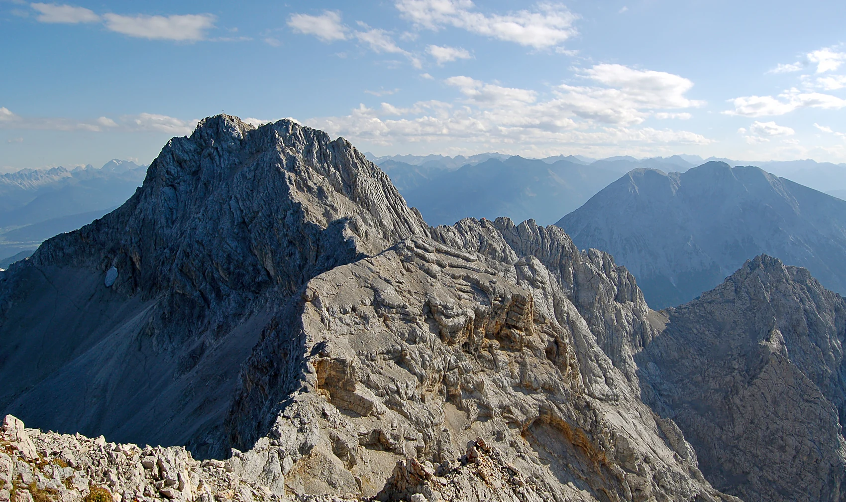
A Documented Ascent in August 1871
Hermann von Barth climbed the Leutascher Dreitorspitze on 7 August 1871 and published a first-person account in the Jahrbuch des Deutschen Alpenvereins in 1872. He traversed the western and central heights of the Partenkirchner group first, then moved toward the Leutascher summit, crossing a small snowfield on the eastern flank and reaching the notch between the north and middle pinnacles before gaining what he identified as the middle and highest pinnacle at approximately 1:15 in the afternoon.
Fog largely obscured the view from the top. Barth recorded that he saw no trace of earlier visitors and left open the question of who reached the summit first. In the photograph taken from the western Partenkirchner summit on 1 September 2009, the Leutascher peak stands on the left, across the gap his route crossed.
Wetterstein Limestone and the Leutascher Platt
East of the high ridge lies the karst plateau known as the Leutascher Platt. The Bavarian State Office for Environment describes the underlying Wetterstein limestone as a product of a Triassic sea. In a 1995 field report, Gerhard Stein noted that the limestone beds at the Platt stand almost vertically. As water dissolves the limestone along the layers, it can carve shafts.
Stein's report records 84 caves on the Platt, most of them small shafts. The passages and shafts follow the nearly upright layers of limestone, linking their shapes to the way the rock was tilted.
Cave Exploration on the Platt, 1982–1995
In 1982, Munich cavers reached 157 metres below the entrance of the Söller-Eisschacht. Rhein-Main cavers began organized fieldwork in 1986, working from the Meilerhütte. Stein’s 1995 account traces the inventory from one cave at the beginning of the project to 84 in its report on the Platt.
The 1995 report gave a depth of 180 metres for the Doppeleisschacht, its deepest recorded shaft. The inventory brought dozens of previously unrecorded cavities into view in the limestone plateau.