
Structure and Setting of the Eastern Range
Department of Water Affairs documentation describes the Langeberg and Outeniqua as parallel ranges of the Cape Fold Belt, with resistant quartzitic strata controlling their profiles and separating the well-watered coastal plain to the south from the semi-arid interior to the north. The Gouritz River system drains both slopes of the eastern Langeberg as well as much of the Little Karoo, eventually reaching the coast between Stilbaai and Mossel Bay through a narrow mountain gorge in the foothills known as Die Poort. The Mossel Bay municipal boundary places the Outeniqua to the north and the Gouritz River to the west, so the eastern Langeberg sector lies broadly northwest of the city across its hinterland rather than within it.
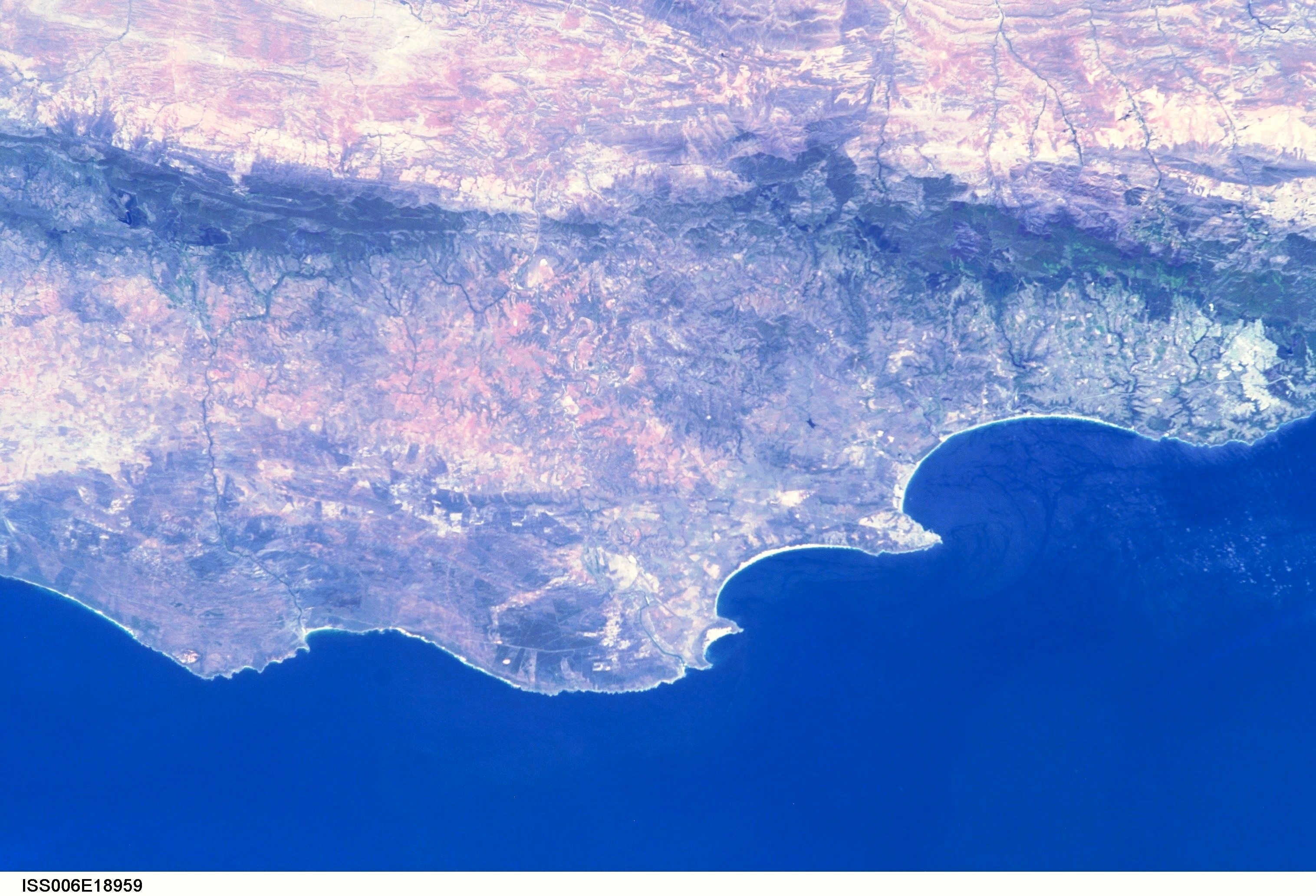
A 2003 photograph taken from the International Space Station (ISS006-E-18959, 12 January) shows elongated dark ridges inland from Mossel Bay, with coastal towns and the Indian Ocean visible to the south. The image geographically documents the eastern Langeberg integrated with its parallel neighboring ridges and the broader coastal landscape, consistent with the river-system descriptions in the South African water department studies.
John Muir’s 1915 Collections
John Muir made a series of plant collections across this sector in May 1915, documented in the Bolus Herbarium catalog. On 1 May he collected Senecio gramineus at Goliath's Berg (Bolus 161400, collector number 2036). On 12 May, Senecio crenatus was recorded at Cloete's Pass (161832, number 2168), and on 13 May, Senecio agapetes from "Goliaths Berg" (161732, number 2034).
Gouritz Cluster and Biodiversity Assessment
UNESCO designated the Gouritz Cluster Biosphere Reserve in 2015, a unit that integrates the Langeberg and Outeniqua ridges with the Little Karoo basin and the southern coast into a single landscape-scale recognition. In 2024, the Key Biodiversity Areas Partnership assessed the Langeberg Foothills as a site of importance for biodiversity.