
Quartzite, River, and the Falls
The Elands River cuts through horizontal beds of Daaspoort Formation quartzite, part of the Pretoria Group, as it descends the escarpment. The 2017 International Continental Scientific Drilling Programme field workshop identified prominent rectangular joints in the hard cliff face, a structural character that defines the escarpment's geometry at this location. Elands River Falls drops approximately 75 metres at this point, as documented by the Mpumalanga provincial source and recorded in the 2017 geological workshop materials. Waterval Boven sits above the break of slope and Waterval Onder below it, the two place names translating respectively as "above the waterfall" and "below the waterfall" in Dutch.
The NZASM Eastern Line and the Tunnel
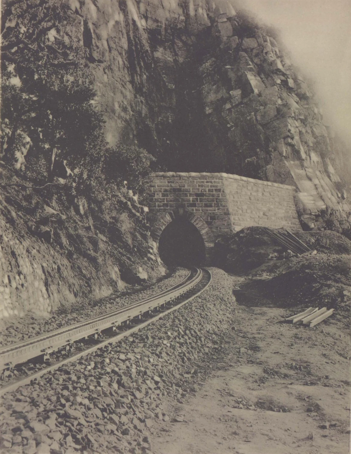
The Netherlands–South African Railway Company, known by its Dutch initials NZASM, built the Eastern Line from Pretoria toward the port of Lourenço Marques, now Maputo, on Delagoa Bay. The Mpumalanga Tourism and Parks Agency records that the line climbed 208 metres over 7.5 kilometres between the two towns, with steep sections at approximately 1 in 20, requiring a cogwheel engaging a centre rack to give locomotives additional grip on the gradient. Workers began the original railway tunnel in October 1892 and broke through in September 1893. The tunnel was about 211 metres long. The public inauguration of the line took place in 1895, the same year the NZASM commemorative volume published a photograph of the tunnel's east portal, showing curved tracks emerging beneath exposed quartzite cliff.
Monument, Deviation, and Surviving Structures
In 1908 a deviation took the railway across the river onto a gentler alignment incorporating two tunnels, superseding the original rack section. The old 211-metre railway tunnel was separately declared a South African national monument in 1962, as documented by both civil engineering and geology sources. The South African Institution of Civil Engineering records that the old Five-Arch Bridge was reused for road transport after the railway changed alignment and was itself declared a monument in 1963. Both structures remain visible landmarks of the successive attempts to engineer a passage through the same quartzite barrier.
First Ascents on the Waterfall Cliffs
The rectangular joints and hard quartzite that shaped railway tunnel placement also define the texture climbers read on the Waterfall Area cliffs. ClimbZA lists named first ascents at this sector in 1991, among them the Cotapaxi crack, climbed by Grant Murray, and The Cat in the Hat, climbed by Richard Lord. The Mountain Club of South Africa's Johannesburg Section documents both sport and traditional climbing at Waterval Boven across the escarpment cliffs. The cliff’s joints open into cracks, edges and corners that shape the lines climbers follow.