
Landform and Setting
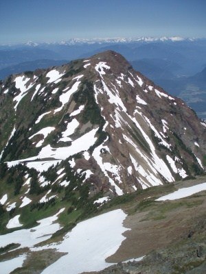
Cheam Peak rises to about 2,100 m as the northern anchor of the Cheam Range, a compact massif that presents a distinct profile when viewed from the Fraser Valley near Chilliwack. The Cheam Range is part of the Canadian Cascades.
Lhílheqey and Tít Tribes Cultural Heritage
In the cultural heritage account recorded by the Tít Tribes and submitted to the Canada Energy Regulator, Cheam Peak is identified as Lhílheqey and described as the mother mountain. The Tít Tribes place this designation within a network of named sites across the Fraser Valley, a living cultural geography that operates independently of federal conventions.
Federal Name Record
The name Cheam Peak appears in the Natural Resources Canada geographical names database, with the naming decision recorded in 1936. That entry establishes the English-language designation in the federal gazetteer but does not address earlier histories. The administrative record and the Tít name Lhílheqey reflect different frameworks through which the same summit is understood.