
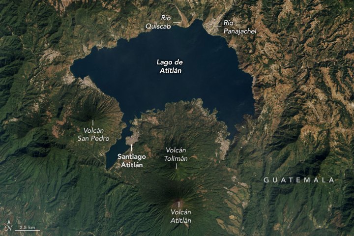
Post-caldera origin and position among the three cones
Lake Atitlán occupies a caldera formed by the eruption known as Los Chocoyos. The precise dating of that event varies depending on the study consulted and should not be fixed to a single figure. The current cone of Atitlán postdates that eruption and emerged as one of three stratovolcanoes that developed along the southern margin of the caldera once the paroxysmal phase had ended. The eruption that formed the caldera and the eruptions of the current cone are distinct volcanic episodes, separated in time and different in nature.
To the north of Atitlán lies Tolimán, another cone situated roughly three kilometers away. The early activity of both overlapped in time. Atitlán is the younger of the two and displays a notably thick mantle of pyroclastic deposits. It is also the tallest of the three post-caldera cones, at 3,535 m according to the Smithsonian.
The confirmed 1853 eruption and the historical record
The Smithsonian's Global Volcanism Program distinguishes the 1853 eruption — classified as predominantly explosive and recognized as the last confirmed eruption in the volcano's timeline — from a report corresponding to 1856 whose reliability is considered uncertain. This distinction between confirmed events and questionable reports defines the scope of Atitlán's documented eruptive history.
Pyroclastic deposits and cone morphology
Atitlán's notably thick pyroclastic mantle is a morphological feature that sets it apart from its neighbor Tolimán. The deposits accumulated during successive eruptive phases shape the cone's form and record, in their layers, the sequence of events that built it. The resulting landscape superimposes two distinct timescales: that of the mega-eruption that formed the caldera and that of the documented explosive activity of the cone, such as that recorded in the nineteenth century.