
The 1960–61 Expedition and the Silver Hut Winter
The ascent of Ama Dablam was embedded within a larger scientific and mountaineering expedition led by Edmund Hillary. Before any attempt on the peak, the team spent the winter at the Silver Hut, a prefabricated high-altitude research station at 5,800 m on Rakpa Glacier near the head of the Mingbo valley, where physiologist Griffith Pugh directed research into human physiological performance at elevation. Mike Gill recalled that the climbers sometimes took days off their scientific work to climb, and the hut served as their de facto base throughout the season. That extended period gave the team sustained familiarity with the mountain's conditions before the summit push.
On 13 March 1961, the summit party of four—Mike Gill, Wally Romanes, Mike Ward, and Barry Bishop—moved above Camp IV on the southwest ridge. On the lower section of that final push, Romanes and Ward cut steps and fixed rope through the technical ground below. An archival Alpine Journal telephoto, taken from near Tengboche, captures the upper mountain on summit day: two ropes of two figures moving across fluted snow toward the top.
The Summit Terrain: Expectation Against Observation
Mike Gill's first-person account of the climb records a specific, telling contrast. The four climbers stepped onto the summit at approximately 2:30 p.m. on 13 March 1961 expecting, as the mountain's profile had always implied, a narrow ice blade. What they encountered instead was a broader snow plateau. A narrow crevasse crossed it, but the summit area was not the impossibly thin ridge its silhouette had promised. Gill's description is worth holding precisely as an observation tied to that date and that party: it is a record of what four people found on a specific afternoon, not a standing characterisation of the terrain in any other season or condition.
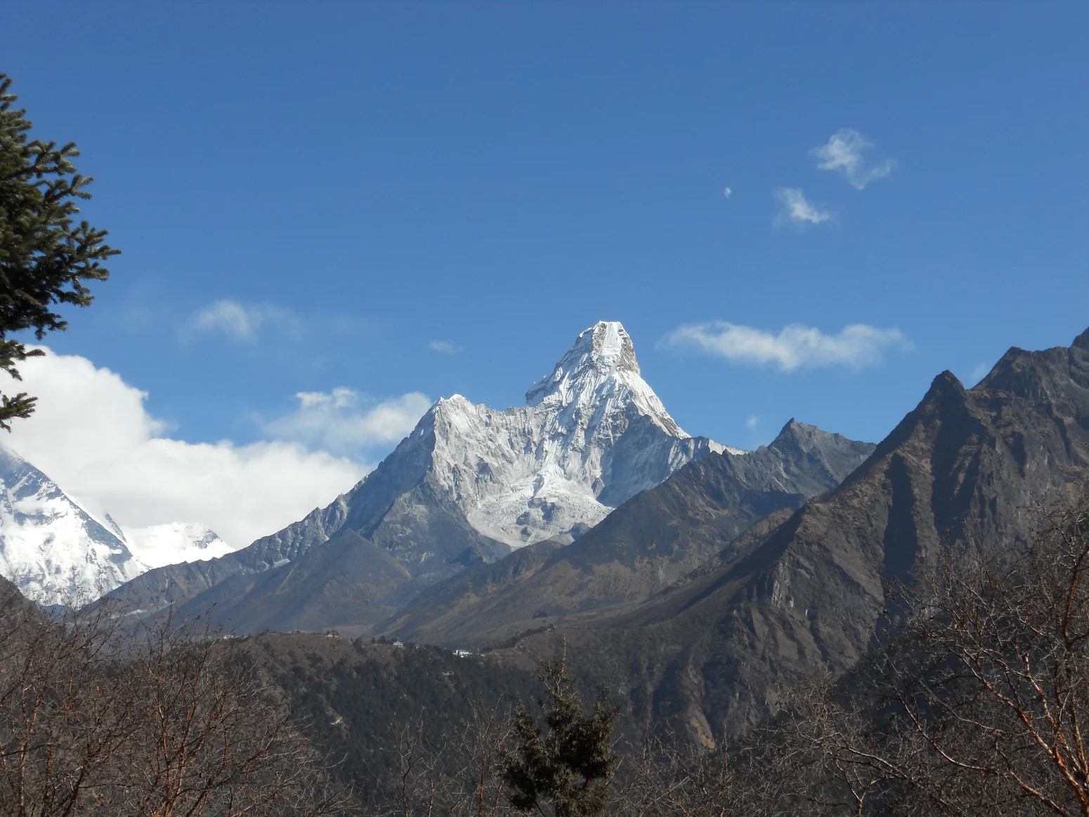
The gap between how Ama Dablam reads from Tengboche and what the first ascent party actually stood on is one of the more concrete illustrations mountaineering literature offers of the difference between a mountain's visual authority at a distance and its physical reality underfoot. The telephoto from the valley compresses and dramatises; Gill's account restores dimension. Both remain part of the peak's documented history, and neither cancels the other.
Name, Measurement, and Catalog Distinctions
Ama Dablam is a mountain of 6,812 m in the Khumbu region of Nepal. It is prominently visible from near Tengboche, where its distinctive profile—a narrow upper ridge flanked by hanging glaciers—has made it one of the most photographed peaks on the approach to Everest base camp.