
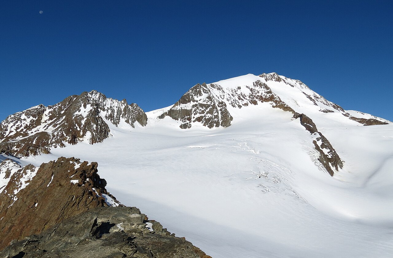
Location and Dual Name
The Weisskugel stands on the state border between the Austrian federal state of Tyrol and the Italian autonomous province of South Tyrol. Its German name Weißkugel — in modern spelling also Weisskugel — and its Italian counterpart Palla Bianca are both in common use and reflect the bilingual character of this border region. Regional maps produced by IDM Südtirol record the summit under the Italian name with an elevation of 3,738 metres.
Comparing the sources reveals a small discrepancy: the regional map gives 3,738 metres, while the Austrian Alpine Club gives 3,739 metres. Both figures should be understood as approximate values that may differ slightly depending on the survey basis used. The Austrian Alpine Club lists the Weisskugel in its inventory of high Ötztal summits separately from the Similaun, Finailspitze, and Wildspitze.
The Langtaufers Valley and Glacial Change
The Langtaufers valley, in Italian Vallelunga, lies on the southern, South Tyrolean side of the massif. The landscape of the valley bears visible traces of glacial retreat: moraine landforms, exposed rock surfaces, and altered drainage patterns document how the ice has withdrawn since the nineteenth century. These changes can be read directly in the valley itself and form the geomorphological context within which the glacier has lost considerable extent over the course of roughly one and a half centuries.
A nature trail in the lower part of the Langtaufers valley makes these glacial changes tangible for visitors. The trail runs through the valley floor and shows, using concrete landmarks, where the ice still reached in the nineteenth century and how far it has since retreated. The trail runs through the valley and is to be distinguished, both topographically and conceptually, from the high summit of the Weisskugel; equally, the Palla Bianca mountain hut mentioned in this context is an independent structure with no direct connection to the summit itself.
The Weisskugel in the Context of the High Ötztal Summits
The Ötztal Alps contain a group of high summits that the Austrian Alpine Club documents separately. The Weisskugel is listed there alongside the Similaun, Finailspitze, and Wildspitze as an independent massif — a classification that underlines its tectonic and topographic distinctiveness relative to the neighbouring peaks. Its position on the state border lends it a particular dual identity, reflected in nomenclature, cartography, and institutional responsibility.
The bilingualism of the mountain's name is not merely a toponymic detail but an indication of the cultural entanglement of the region. The fact that IDM Südtirol, the South Tyrolean marketing agency, records the Palla Bianca in its regional cartography while the Austrian Alpine Club lists the same mountain under the German name Weisskugel illustrates the administrative and cultural dual nature of this border summit in a concrete way.