
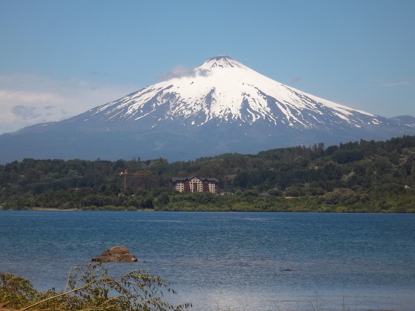
Form and Position in the Territory
Villarrica sits on the boundary between the regions of La Araucanía and Los Ríos, according to SERNAGEOMIN's technical sheet, and its pronounced conical silhouette dominates the basin in which lakes Villarrica and Calafquén lie, along with the city of Pucón. This geographical position makes the volcano a visual and identity landmark for the entire lake district. The cone rises relatively steeply from the forested foothills of the park towards the permanent snowfields and the volcanic glacier covering its upper flanks, giving the whole a visual stratigraphy that runs from temperate rainforest to active ice within just a few kilometres of vertical gain.
Active Volcanism: Composition, Crater and Glacier
SERNAGEOMIN describes Villarrica's eruptive history as a combination of lava flows and tephra deposits, with ancient calderas formed during larger-scale explosive episodes. The crater, documented as open, features a lava lake of variable height, a characteristic that places it among the volcanoes with the most persistent surface activity in South America. The institution also documents a volcanic glacier at the summit whose interaction with hot eruptive material constitutes the primary source of lahars — flows of mud and volcanic debris — in the surrounding valleys. The explosive episode of 2015 is the most recent recorded in SERNAGEOMIN's fact sheet; any assessment of the volcano's current state should be referred to that body's current reports.
Not far from Villarrica, the volcanoes Quetrupillán and Lanín complete a chain of eruptive centres that SERNAGEOMIN identifies as independent structures within the same volcanic arc. This proximity underlines the character of the southern Andes as a territory where volcanism remains an ongoing geological process, not a phenomenon of the past.
Rucapillán: The Name and the Park
CONAF uses the name Rucapillán for the volcano, thereby preserving a designation of Mapuche origin that coexists with the colonial-era toponym. CONAF's regional fact sheet does not offer an explicit etymology, so any interpretation of the name's meaning should be considered tentative. Parque Nacional Villarrica, established in 1940 according to CONAF's regional document, protects the territory stretching from the foothill forests to the high-altitude volcanic zones, encompassing within a single space the ecological diversity of the Chilean Andean slope.
CONAF's management of the park covers both the forested sectors at the base, with their cover of species characteristic of the Valdivian forest, and the alpine environments and the immediate surroundings of the crater. This altitudinal gradation — from araucarias and coihues to volcanic rock and ice — is one of the features that distinguishes Parque Nacional Villarrica within the network of protected areas in southern Chile.
Lakeland and Volcanic Landscape as a Whole
The relationship between Villarrica and the lakes surrounding it is not merely aesthetic. The lahars documented by SERNAGEOMIN have those lake valleys as their direct zone of influence, making the landscape a system in which volcanic dynamics and hydrology are closely linked. Lakes Villarrica and Calafquén, which SERNAGEOMIN mentions as geographical references of the immediate surroundings, are in part the result of volcanic and glacial processes accumulated throughout the Quaternary. The city of Pucón, situated on the shore of Lake Villarrica beneath the view of the snow-capped cone, represents perhaps the most visible example of the daily coexistence between an established human community and one of the most active volcanoes on the continent.