
Flank Collapse and Subsequent Infill
During the Pleistocene, Ollagüe's western flank collapsed and the debris avalanche deposit spread toward the Salar de Carcote and surrounding salt flats. Subsequent volcanism partially refilled that amphitheater with new lavas and the dacitic dome that forms the summit today.
Chilean observers have recorded historical intensifications of the fumarole, although independent sources differ on whether historical eruptive activity can be confirmed.
High-Altitude Sulfur Mining
The Santa Rosa deposit operated on the slopes of Ollagüe, distinct from the Aucanquilcha operations. A 1,415 m aerial tramway carried sulfur from 5,254 m down to 4,747 m, where it connected with a longer line to Buenaventura and onward by rail to Antofagasta. Telegrams from 1959 document fluctuations in staffing and dependence on specialist miners.
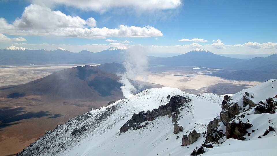
Fumarole Documented in 2012
A photograph taken from the summit in January 2012 records steam rising from the south-southwest sector of the volcano, placing the fumarolic activity within a specific period.