
The 2008 eruption and the rhyolitic dome sequence
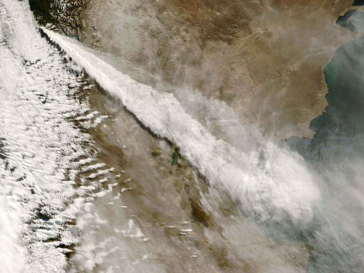
According to the USGS technical chronology, the eruptive sequence began during the first eleven days of May 2008, with 2 May as the start date in that institution's retrospective review. The initial phase was intensely explosive and generated an ash column observable from NASA's Terra satellite on 3 May. In mid- to late May, simultaneous extrusion of ash and lava began, followed from June through September by lava flows over the dome surface, spine extrusion, and endogenous growth. The resulting rhyolitic dome reached an estimated volume of approximately 0.8 km³.
The eruptive episode spans chronologically from 2008 to 2009, with a closing date that USGS research places in late 2009 or possibly early 2010, an uncertainty that reflects the difficulty of precisely delimiting the end of the dome's endogenous growth processes. The composition of this lava is rhyolitic, a geochemical characteristic that determines the magma's high viscosity and the observed eruptive style.
The evacuation of Chaitén and the immediate impact of the ash
The port town of Chaitén, located approximately 10 km south of the volcano, was evacuated within roughly five days of the eruption's onset. Fine ash generated during the initial explosive phase was deposited across wide areas of Chile and Argentina, with a cross-border dispersal that illustrates the geographic reach of explosive eruptions of rhyolitic composition, whose lighter material remains suspended and is carried by winds over great distances.
Rain, lahars, and fluvial transformation
In the days following the onset of the eruption, rainfall on the volcano's slopes — blanketed by layers of ash and pyroclastic material — triggered accelerated erosion. Rainwater mobilised large volumes of sediment into the Chaitén River, causing rapid aggradation of the riverbed — the raising of the channel floor through sediment accumulation — followed by lahars and floods that inundated much of the already evacuated town. This mechanism illustrates how an eruption can cause severe damage in drainage basins adjacent to the volcano through the interaction between precipitation and volcanic deposits on the slopes.
The complete sequence of events — explosive eruption, dome formation, ash dispersal, and subsequent fluvial destruction — provided exceptional field data that helped drive the expansion of volcanic monitoring systems in Chile. The Chaitén case demonstrated that volcanoes with apparently brief historical records can reactivate violently, and that the secondary hazards associated with post-eruptive erosion deserve the same scientific attention as the eruption itself.