
Valley Form and Geological Structure
The Bhutan biodiversity baseline documented an elevational sequence along the Paro Chhu from roughly 2,600 to about 4,500 metres. The lower reach accumulates sediment across broad terraced floors and tributary fans, while the middle section between approximately 2,900 and 3,700 metres cuts a narrow, V-shaped forested gorge — a zone of active river incision. Above roughly 3,700 metres the valley opens into a wide, U-shaped trough characteristic of glacial erosion.
The same survey describes the Jhangothang Fault as the contact between the Barishong and Thimphu formations. The valley walls reflect this geological boundary as well as ice erosion. The southeast wall rises steeply in hard rock, while moraines and other loose deposits mantle the gentler northwest slope. Cooper and colleagues mapped the wider Jomolhari–Jichu Drake range in a 2015 study of tectonic deformation.
Seasonal Water Sources and High-Altitude Hydrology
Between May and October 2019, the Bhutan National Center for Hydrology and Meteorology collected water samples at multiple sites along the Paa Chhu sub-basin — the name used in NCHM survey records for the same drainage — including source waters and the confluence surveyed at an elevation of 4,051 metres near Jangothang. Geochemical and isotopic analysis was used to separate the contributions of rain, snowmelt, glacier melt, and moraine seepage across the sampling period.
The study's four-source model found that rain generally accounted for the largest share at the lower sampling sites. Glacier melt played a larger role higher in the valley. Repeated sampling showed how the shares changed from month to month through the monsoon season.
Glacial-Lake Observations Above Jangothang
In 2019 Cristian Scapozza and colleagues studied Wa-007, a lake sitting on debris-covered ice on the Thangothang Chhu glacier below Jichu Drake. The team combined satellite mapping with simulations of water travelling down the valley after a hypothetical breach. Near Jangothang village, the lowest river terrace stands only about two to three metres above the channel. The location of the houses on these terraces matters to the movement of water in the simulations.
After a flood on 9 August 2026, Bhutan's National Center for Hydrology and Meteorology and the Paro district surveyed the Jechu Drake Glacier. They traced the surge to a breach in the ridge of glacial debris holding back a smaller lake, about two kilometres uphill from the main lake. The water apparently travelled through the ice before reaching the larger lake and passing downstream through its existing outlets. The field team mapped the glacier with a drone and surveyed the depth of the main lake using sonar.
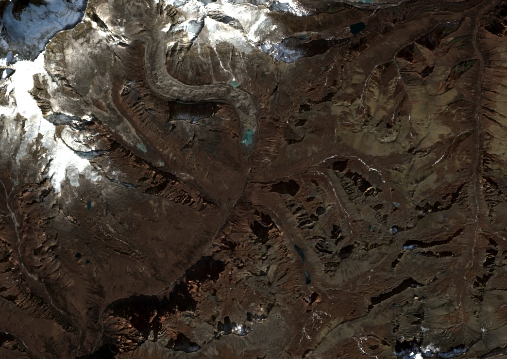
The December 2024 satellite view shows the bends in the debris-covered glacier and the channels that carry water down the upper valley. A Bhutan biodiversity survey recorded ridges of glacial debris marking former ice margins and described glacial lakes at the fronts of both the Jichudrakey and Jomolhari glaciers.
Inhabited Landscape and Study History
The valley floor supports permanent settlements, and herders graze yaks on the surrounding slopes. The Bhutan Tourism Corporation documents a trail following the river between the Soe settlements and Jangothang. A botanical record gives a precise date and place for the species. G. and S. Miehe collected the type specimen of the primrose Primula rebeccae near Jangothang at 4,000 metres on 6 July 2000.
Jigme Dorji National Park and the Bhutan Foundation launched the Jomolhari Mountain Festival in 2013. At the second festival in 2014, highland communities shared music, dance and food alongside activities about snow leopard conservation.