
Geology and Physical Structure
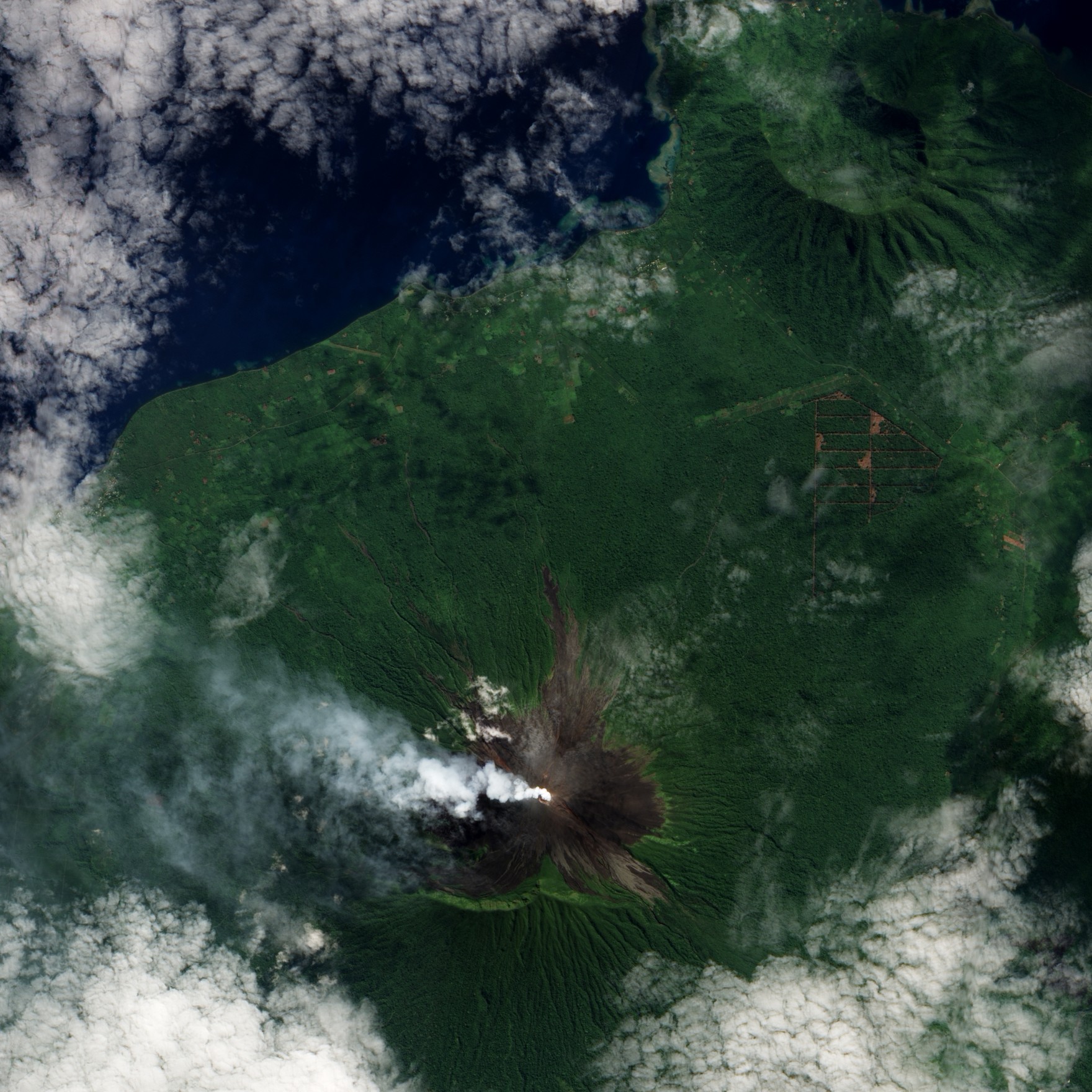
Ulawun is built from basaltic to andesitic lavas and pyroclastic deposits. A pronounced east–west escarpment on the southern flank may record large-scale structural slumping in the edifice's history. Satellitic cones occupy the northwestern and eastern flanks, and a steep-walled valley incises the northwestern side, with a lava-flow complex lying to that valley's south.
Eruptive History and Summit Modification
Eruptions at Ulawun have been documented since the beginning of the eighteenth century. Activity through most of the twentieth century was mildly explosive in character, but after 1970 several larger eruptions produced lava flows and basaltic pyroclastic flows. These more energetic events substantially reshaped the summit crater, distinguishing the present configuration from its pre-1970 form.
Observed Plume Activity
Photographic documentation published by NASA's Earth Observatory in June 2010 shows a plume of ash or steam rising from Ulawun, providing a point-in-time record of activity at the volcano. The imagery is consistent with Ulawun's recurring pattern of eruptions within the Bismarck arc and with its standing as one of Papua New Guinea's most frequently active volcanoes.