
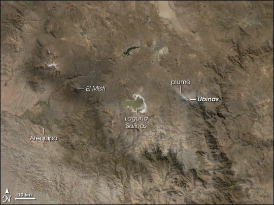
The Ubinas valley and the Volcanmayo ravine
The Ubinas valley contains communities such as Querapi, Ubinas and Sacohaya. According to the IGP study of seismicity in April 2006, the Volcanmayo ravine acts as a corridor connecting the southern flank of the volcanic edifice with that valley, establishing the topographic relationship between the volcano and the communities situated to the south.
Three eruptive cycles and satellite thermal analysis
Between 2006 and 2019 Ubinas passed through at least three periods of activity: the 2006–2009, 2013–2017 and 2019 cycles. The IGP used Landsat satellite imagery to analyse thermal anomalies recorded in the crater during those periods. For the first two cycles, the researchers interpreted some of those anomalies as a possible indicator of exposed lava in the crater, an interpretation the authors themselves present as probable but not definitive. The anomalies recorded in 2019 were attributed primarily to degassing, a process that does not necessarily imply the presence of visible molten material.
A thermal anomaly in the crater is a measurable datum; its cause requires additional analysis and admits varying degrees of certainty. The IGP studies of Ubinas show how Landsat analysis can yield different readings depending on the eruptive context in which it is applied.
Field seismology and complementary monitoring
During the April 2006 activity, the IGP installed seismic stations both in the vicinity of the crater and at positions distributed around the volcanic edifice. This network configuration makes it possible to locate the foci of seismic events and characterise the mechanisms that generate them, complementing what the satellite thermal data contribute regarding the crater surface.
The combination of field seismology and infrared remote sensing forms the methodological core with which the IGP has studied the recent cycles of Ubinas, allowing hypotheses to be tested against independent sources.