
Formation and Expansion
Sakai, Chikita, and Yamada's 2000 reconstruction in Limnology and Oceanography suggests the lake was probably no more than a small pond in the early 1950s. As the Trakarding Glacier retreated, meltwater accumulated behind the terminal moraine and the basin elongated and deepened: the ice that once occupied the upper basin was replaced by open water. The IPCC Fourth Assessment Report cites mapped lake areas of approximately 0.23 km² for 1957–58 and 1.65 km² for 1997, an increase of more than sevenfold over roughly four decades. Field measurements by Chikita, Jha, and Yamada published in 1999 documented both the lake's dimensions and its ongoing expansion during that period.
The lake grew upstream as the front of the glacier receded. Researchers also found that buried glacial ice was melting below the lake, allowing the basin to deepen. The ridge of glacial debris at the lower end continued to hold this growing volume of water.
Risk Assessment and Controlled Drainage
By 1997 Nepal had placed Tsho Rolpa on its national priority list of glacial lake outburst flood hazards. The concern centered on the pressure of accumulated water against the terminal moraine: a breach could release a sudden, destructive flood downstream through the Rolwaling Valley. A controlled outlet was engineered through the moraine, and according to the DHM/ICIMOD Nepal country report the water level was lowered by 3 m in 2000. The IPCC Fourth Assessment Report records the broader project as completed in 2002; the two milestones mark distinct phases of the same intervention.
Lowering the water level reduced the pressure on the moraine and the volume that could escape in a flood. Researchers continued to monitor the lake and the glacier after the outlet opened.
Recent Glacier Retreat
In 2019 the International Centre for Integrated Mountain Development revisited the basin. Its report found that the Trakarding Glacier, which it calls Tarkading, had retreated by about 60 metres a year on average between 2009 and 2019.
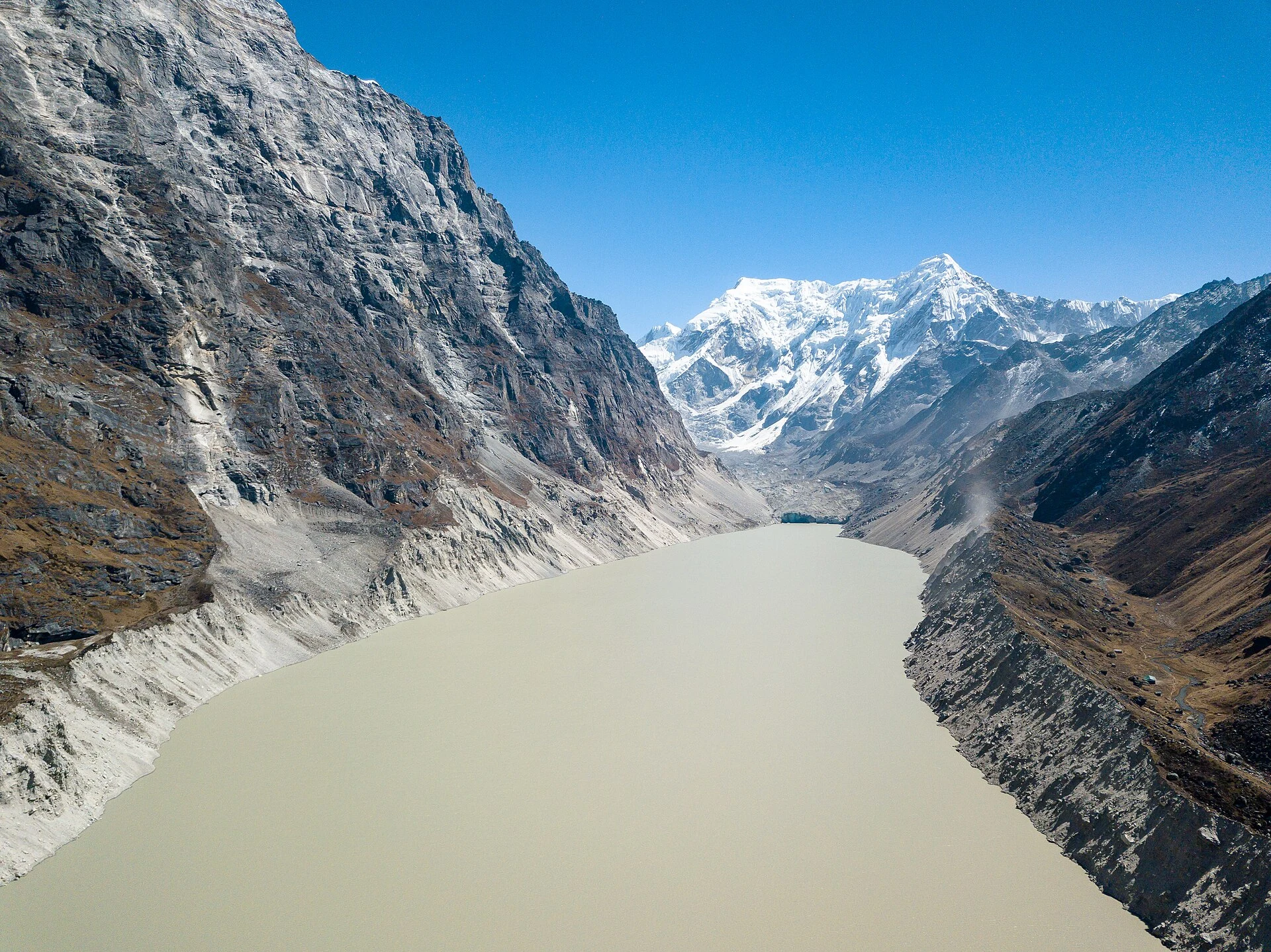
In Nammy Hang Kirat’s 2018 photograph, the surface of the lake stretches away between steep mountain walls. The view shows how a strip of open water has become a defining feature of the upper Rolwaling Valley.