
Geology and hydrology of the slopes
In 1982, Georges Rossi recorded basaltic lava flows on the western flank of the massif and placed them within the broader geology of northern Madagascar. According to Madagascar National Parks, five rivers have their source within the reserve, including the Ramena and the Sambirano. Their valleys connect the highlands to the plains downstream.
The strict nature reserve was established by decree on 31 December 1927, then supplemented by Decree No. 66-242 of 1 June 1966, according to the Madagascar Protected Areas Observatory.
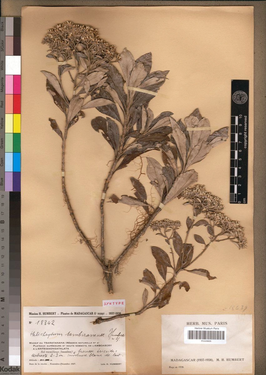
A botanical collection from 1937
Between November and December 1937, Henri Humbert collected this specimen on the high plateaus, between the Amboabory and the Antsianongatalata. The herbarium sheet at the Muséum national d'histoire naturelle bears the collection references, including the number 18342, along with a description of the basaltic rocky terrain and heathland vegetation. It holds a syntype, one of the reference specimens used to describe Helichrysum sambiranense.
Entomological sampling on the western slope in 1966
In October 1966, P. Soga collected moths in the Andavaka valley at 1,850 m, and at Andilambe at 2,400 m. In 1970, C. Herbulot published these two stations on the western slope in the Mémoires de l'ORSTOM. The records place each collection at a precise altitude.
The same slopes, ten years later
Researchers surveyed amphibians and reptiles along the same altitudinal transect in 1993 and in 2003. Their 2008 paper reports a mean upward shift of 36.6 m in the midpoints of the observed altitudinal ranges, averaged across five analyses. The magnitude of the shift varies between analyses. The authors treat this comparison of two survey campaigns as a preliminary result.