
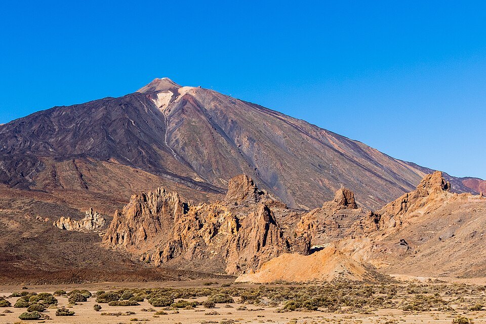
Two summits within an older landscape
Teide and Pico Viejo form a volcanic complex that grew through successive eruptions. Teide dominates the Las Cañadas depression, and the wide crater of Pico Viejo is distinguishable on the western flank of the complex. UNESCO and the Instituto Geográfico Nacional give 3,718 metres in their descriptions of the volcano, while the Atlas Nacional de España records an elevation of 3,715 metres.
In 1798 eruptive vents opened on the flank of Pico Viejo. They are known as the Narices del Teide. Their lavas spread westward across the park and left rough surfaces of dark rock. The Roques de García, by contrast, display landforms sculpted by erosion in older volcanic materials.
Echeyde and the mountain Humboldt studied
The Guanche account recorded by the Spanish ministry places the dwelling of Guayota at Echeyde. In one version of the legend, Guayota imprisons the Sun inside the mountain and Achamán frees it before sealing the mouth of the volcano. The story preserves the cultural memory of a community that lived alongside an active volcano.
Alexander von Humboldt visited Tenerife in 1799 and studied its flora. The ascent from the coast allowed him to observe how vegetation changes with altitude. Today the Teide violet is a good example of that change. It grows on the stony slopes of the high Canarian mountains, even above 2,500 metres.
What can be seen from Las Cañadas
From the Roques de García you can compare the floor of the depression, the cliffs that surround it, and the Teide cone. The Siete Cañadas trail runs along part of the base of the southern wall. On the park map, the Telesforo Bravo trail corresponds to the upper section linking La Rambleta with the summit crater.
The park was declared in 1954 and entered the World Heritage List in 2007. UNESCO highlighted the concentration of volcanic forms within a small area, where different stages in the formation of an oceanic island can be recognised.