
Landforms and Regional Setting
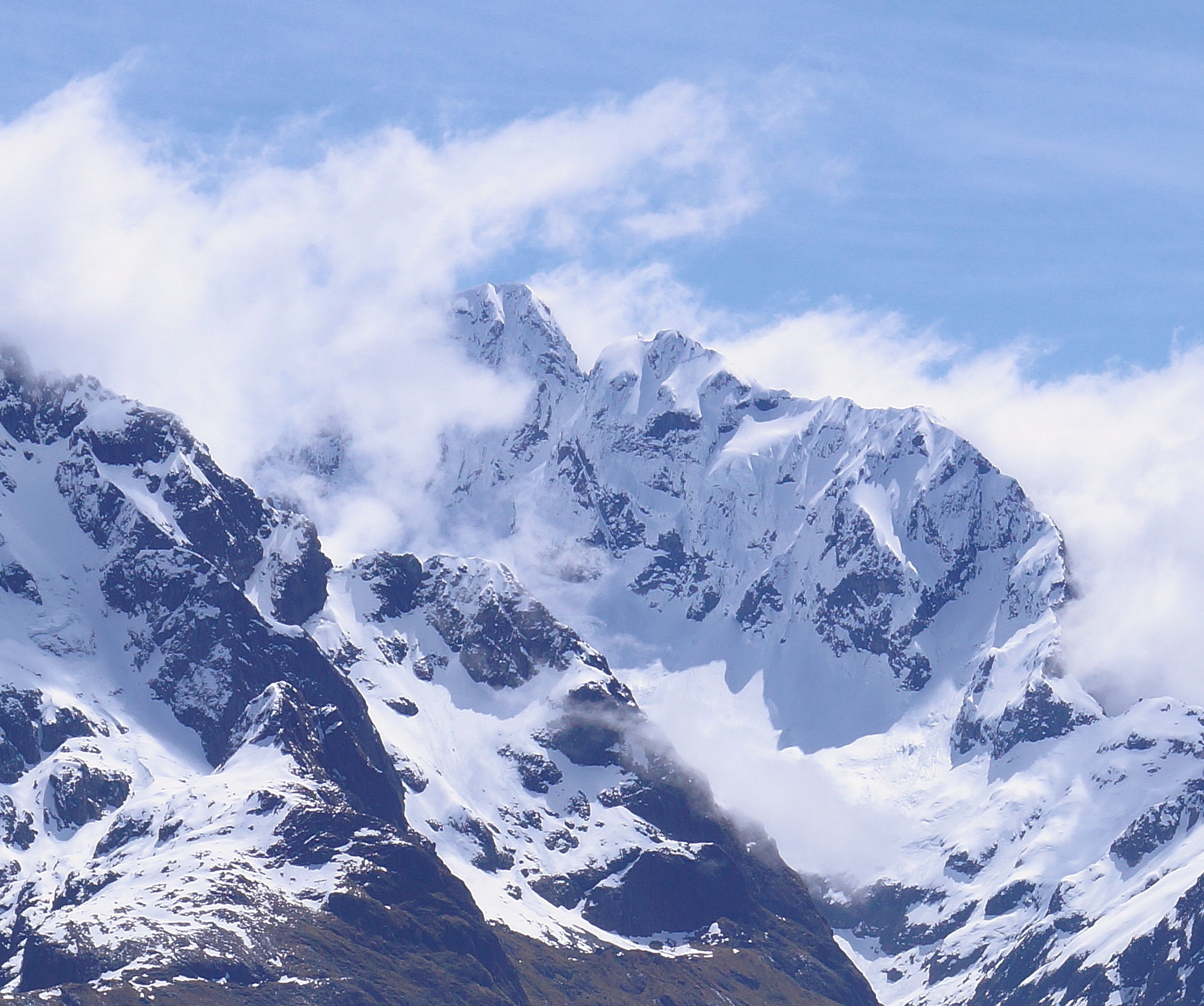
Te Wera is the highest point of the central Darran Mountains. The landscape pairs steep rock pyramids with bowl-shaped hollows cut by glaciers. The neighboring Early Cretaceous Darran Complex contains hard intrusive rocks, and the much younger glacial landforms are part of the Te Wahipounamu World Heritage property inscribed in 1990.
Te Puoho Glacier lies below the summit at the head of Chasm Creek. Lake Turner occupies another basin on the northwest side. In the view from the Routeburn Track, snowy gullies and exposed rock trace the steep southeast face back to the summit.
Ridge Climbs and Early History
In 1938 David Lewis and Lindsay Stewart climbed across Te Puoho Glacier and used cols below the south and west ridges to reach the north ridge. Phil Houghton and Mike Gill climbed the east ridge in February 1959 and descended the south ridge, making the mountain’s first recorded traverse. James Speirs, Rich Turner and Dave Vass climbed the full north ridge in February 2011.
Harold Jacobs and Murray Jones added the west ridge in February 1969. In February 2001 Brigid Allan and Anna Gillooly established the West Ridge Direct from the Lake Turner side, taking a steeper rock buttress before rejoining the upper ridge — a variation that opened an independent approach from the northwest basin and extended the historical record on that aspect of the peak.
Rock Routes on the Connecting Ridge
The American Alpine Journal’s report on the 2005–06 season records Richard Thomson, Richard Turner and Dave Vass climbing six rope lengths on the red wall between Te Wera and Karetai. Their route, Statue Bro?, finishes just south of Karetai Col.
Ben Dare’s report on the 2015 season records climbers opening further rock lines along this connecting ridge, including on the west face of Nga Mokopuna, a 2,073-metre subsidiary peak. The steep walls between the summits offered objectives in their own right.
Name and Administrative Record
A 1939 naming decision recorded Te Wera and Te Puoho Glacier as separate features in the Caples Survey District, Southland. Both appear in the New Zealand Gazette of 29 July 1948.