
The Rabaul Caldera Setting
The Rabaul caldera, measuring roughly 8 by 14 kilometres, formed approximately 1,400 years ago and is broadly breached on its eastern side, where seawater from Blanche Bay floods the caldera floor to create the sheltered harbour that made Rabaul a significant settlement. An earlier caldera-forming event, estimated at around 7,100 years ago, is attributed to the Tavui caldera offshore to the north. Post-caldera activity built basaltic-to-dacitic pyroclastic cones along the northeastern and western interior walls; Tavurvur is among these cones, situated on the northeastern side.
The 1994 Simultaneous Eruption
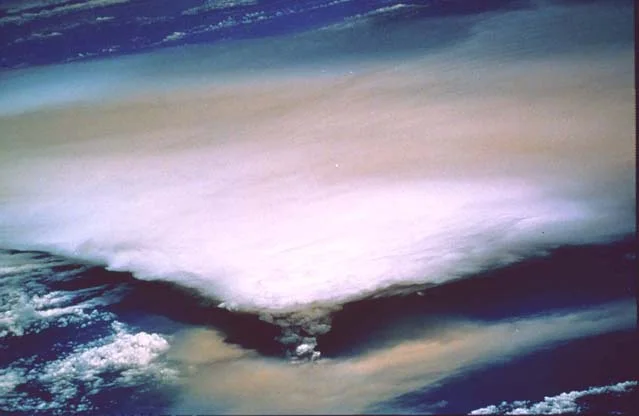
In September 1994, Tavurvur and Vulcan — two separate vents on opposite sides of the Rabaul harbour — erupted simultaneously in a powerful explosive event. Vulcan cone had formed during a large eruption in 1878 on the caldera's western side. The 1994 eruptions together forced the temporary abandonment of Rabaul city, then the largest urban centre on New Britain, demonstrating how distinct vents within the same caldera system can activate in close succession.
The 2014 Eruption and Ash Dispersal
On 29 August 2014, Tavurvur produced an explosive eruption that generated a significant ash column. Satellite imagery shows ash deposited across forest to the west of the cone, reflecting the directional influence of wind on tephra dispersal during the event.