
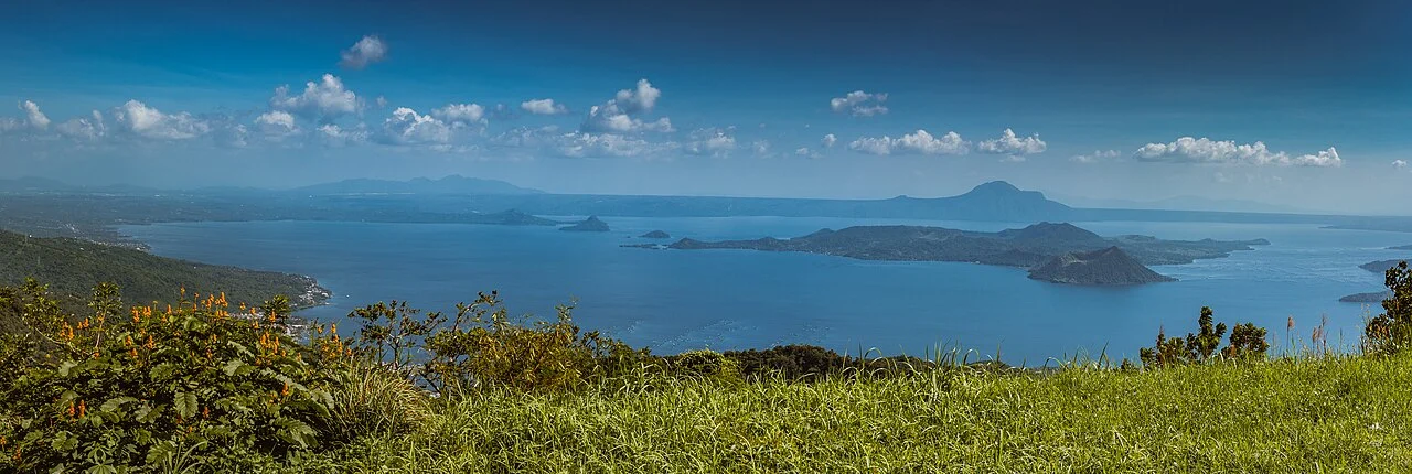
A Landscape Built in Layers
The caldera that now cradles Lake Taal is the product of eruptions large enough to collapse the ground surface inward over geological time. Lake Taal fills most of the outer caldera. Volcano Island is a younger construction layered on top of that older basin floor, assembled from multiple cones and craters rather than a single vent system. Main Crater is one vent on the island. Some documented eruptions have involved the interaction of magma or geothermal heat with water at various interfaces within this nested structure.
The lake itself becomes a participant in eruption events. During the violent 1911 episode at the Main Crater documented by PHIVOLCS, the energy release was sufficient to generate seiches on the lake — oscillations of the water mass within the basin, comparable to the sloshing of water in a container set vibrating, moving across the surface as a series of waves. That the lake could be set in measurable motion by activity on the island underscores how tightly coupled the water body and the volcanic system are.
The 1911 Eruption and Its Pyroclastic Record
PHIVOLCS documents the 1911 Main Crater episode as one of the more violent events in Taal's historical record, notable in part for the generation of pyroclastic density currents — fast-moving mixtures of hot gas and fragmented volcanic material that travel along the ground surface rather than rising into the atmosphere. Such currents are distinct from airfall ash columns and represent a different category of hazard from ballistic projectiles or lava. The 1911 event is recorded separately from later eruptions in the PHIVOLCS eruption history, which tracks the volcano's activity across multiple centuries of observation.
January 2020 and the Tephra Column
On 12 January 2020, the Main Crater produced an eruption that PHIVOLCS observed generating a steam-rich tephra column rising 10 to 15 kilometres above the vent. Tephra — the collective term for all fragmented material ejected during an eruption regardless of size — fell across Volcano Island and reached towns in the surrounding region. PHIVOLCS also documented lava fountaining during the event, indicating that magmatic material reached the surface in liquid form alongside the explosive column. The eruption involved the interaction of magma or high-temperature processes with water, though the precise mix of eruptive styles across the event's duration was not uniform.
Ashfall from the January 2020 eruption extended well beyond the lake basin, affecting communities in Batangas and surrounding provinces on Luzon. The 10 to 15 kilometre column height placed the eruption in a range capable of distributing fine ash over large distances downwind, with consequences for agriculture, infrastructure, and air quality in the affected area. The event drew renewed attention to the dynamics of island-within-lake volcanic systems and to the particular challenges of monitoring a structure where the boundary between volcanic vent and body of water is as geologically active as it is at Taal.
Nomenclature and Survey Context
The name Taal refers to the broader volcanic complex in common and scientific usage, though the most visible and frequently discussed feature is the Main Crater on Volcano Island. The 311 metre figure recorded by the Smithsonian Global Volcanism Program is the volcano's elevation above sea level. PHIVOLCS, as the Philippine government agency with direct monitoring responsibility, maintains the authoritative eruption history and observational record for the complex, and its accounts of individual eruptions are the primary basis for understanding the sequence and character of Taal's historical activity.