
Basement Rock Groups and Structural Mapping
The Geological Magazine has published field mapping identifying the major rock groups of the northern Red Sea Hills, distinguishing granites, syenites, and metamorphic units shaped by Precambrian tectonics. Al Neelain University extended this work through Landsat imagery and field reconnaissance across the Haya Terrane, refining the distribution of rock units and the structural framework of the range.
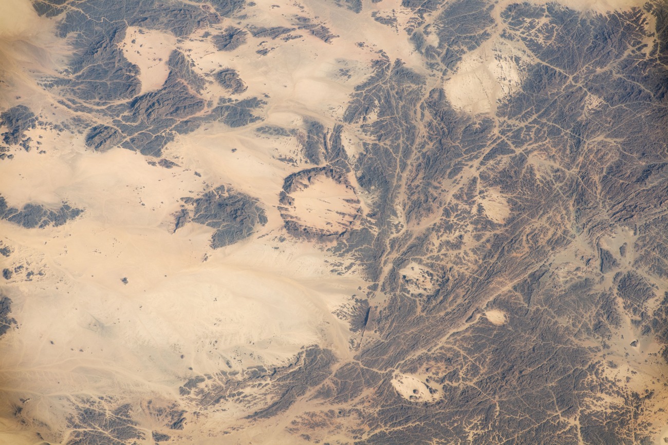
ISS Photograph of 12 April 2022
On 12 April 2022, astronauts aboard the International Space Station captured an image of part of the Red Sea Hills for NASA's Johnson Space Center Earth Observation Laboratory. The photograph reveals granites and syenites across the recorded area, along with the Hamisana Shear Zone and a ring complex approximately 15 kilometres across dated to 624 million years ago.
Jebel Erba and Oda as Distinct Mapped Features
Al Neelain University mapping using Landsat data and field reconnaissance treats Jebel Erba and Oda as separately named and mapped features within the Red Sea Hills. The two mountains occupy distinct positions within the range, and the university study documents the terrain through combined remote sensing and ground-based observation rather than summit measurement alone.