
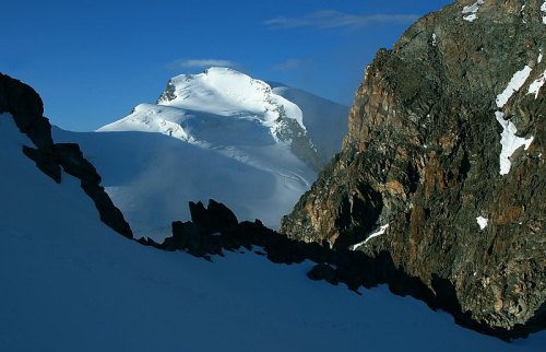
Location and topographic classification
The Strahlhorn occupies a geographically exposed position within the Allalin Group: as the southernmost four-thousander of the entire chain, it lies just a few kilometres from the border with Italy. To the west the view opens onto the Matter Valley, to the east onto the Saas Valley – the glaciated ridgeline between these two valleys defines the tectonic axis on which the Strahlhorn has its place.
Immediately to the north-west rises the slightly higher Rimpfischhorn (4,199 m), with which the Strahlhorn is connected via the Adler Pass at 3,786 m. About three kilometres further north follows the Allalinhorn (4,027 m). This spatial sequence makes the Adler Pass a central link within the group.
First ascent 1854
On 15 August 1854 Christopher Smyth, Ulrich Lauener, Edmund J. Grenville and Franz-Josef Andenmatten made the first ascent of the Strahlhorn. The ascent took place during a period of intensive alpine exploration in which numerous Valais four-thousanders were climbed for the first time. Franz-Josef Andenmatten, an experienced mountain guide from Saas, was in those years one of the most sought-after guides in the region.
Between the Mischabel Group and Monte Rosa
The Strahlhorn's position between the Mischabel Group to the west and the Monte Rosa Massif to the east gives it a special role as a link between two of the most significant high-mountain groups in the Swiss Alps. While the Mischabel Group ranks as the second-highest massif in Switzerland after the Monte Rosa Group, the Strahlhorn marks at its southern flank the transition to the heavily glaciated Monte Rosa area. Its location on the municipal boundary between Saas-Almagell and Zermatt reflects this topographic dual character.