
Landform and Geology
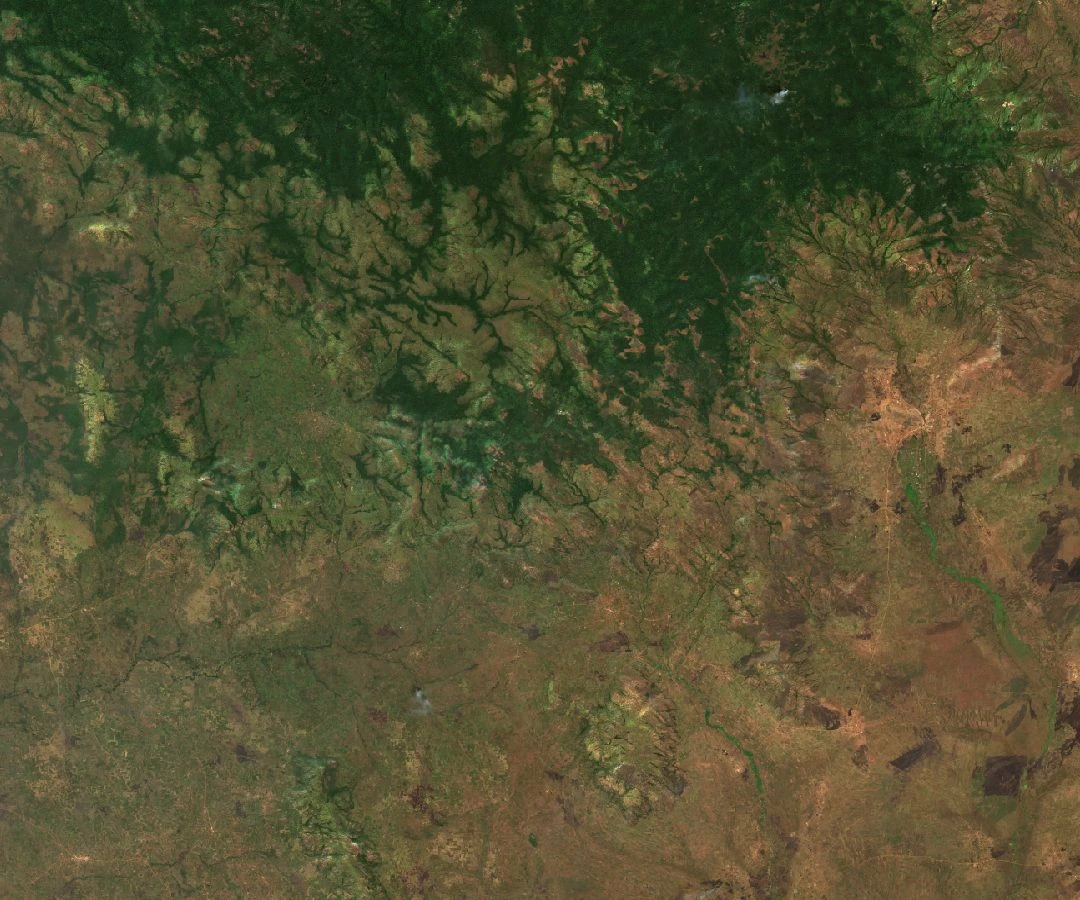
A Sentinel-2C image from 8 January 2026 shows the Agoro–Agu hills as a system of branching ridges descending from the southern Imatong slopes, with denser, darker canopy on the upper massif meeting lighter, more open terrain to the south. The underlying rock, described by Okullo and colleagues in a 2021 study, consists of folded and foliated crystalline granitic formations — a basement geology typical of the broader East African Rift margins.
Vegetation across this elevation gradient is transitional, mixing savanna woodland species characteristic of the lower surroundings with East African montane forest species on the higher slopes. The hills themselves straddle the South Sudan–Uganda border, though the named Agoro–Agu Central Forest Reserve is administered on the Ugandan side.
Reserve History and Participatory Planning
The Uganda Forest Working Group traces the gazettement of the Agoro–Agu Central Forest Reserve to 1937. In 2018 the National Forestry Authority and Uganda's Ministry of Water and Environment, with support from IUCN Uganda, moved to broaden participation in updating the reserve's management framework. Local governments and resident communities contributed to shaping both reserve-specific and wider landscape plans, a process documented by Omoding and colleagues in a 2020 study published in IUCN PARKS.
The 2020 study distinguishes between the formally gazetted reserve and the broader management area surrounding it — an important legal and administrative distinction given the cross-border character of the Agoro–Agu hills as a whole.
Tree Communities Across the Slope
A 2021 study by Okullo and colleagues sampled vegetation using 15 transects, each two kilometres long — a transect being a line across which a series of sampling plots is laid out at intervals. Across all plots combined, the survey recorded 100 tree species in 36 families. These figures describe the sampled plots, not a complete inventory of the mountain range.
The results reveal a sharp difference in species composition by elevation. Mid-slope plots yielded 87 species, reflecting the transitional character of that zone where savanna and montane assemblages overlap. Ridge-top plots recorded only 22 species, consistent with the more constrained conditions at higher elevations. Together, the two groups of plots document how tree communities contract and specialise moving up the Agoro–Agu slopes.