
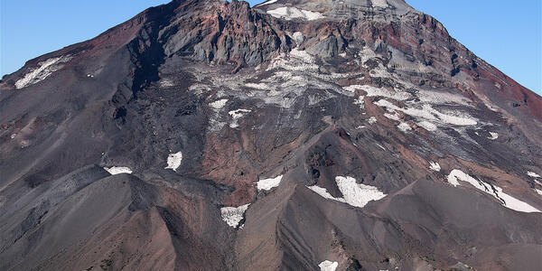
A Summit Built in Stages
USGS dating places the earliest rhyolite flows and domes at approximately 50,000 to 45,000 years ago. Later lava and explosive deposits built the upper cone, with the main phase of summit construction ending around 22,000 years ago. The andesite lava flows and scoria layers now visible on the northeastern face record eruptive episodes from that construction period. Prouty Glacier cut into the mountain deeply enough to expose this internal sequence as a readable stratigraphic profile.
Flank Vents and Late Rhyolitic Episodes
After the main summit cone stopped growing, volcanic activity continued at flank vents. Around 2,200 years ago, a rhyolitic episode at the southwest foot of the mountain produced Rock Mesa. About 200 years later, a second episode formed the Devils Chain along the southeastern flank. The Devils Chain comprises approximately 20 domes and thick flows extending across 5 kilometres, with an additional shorter northern line of vents.
Rock Mesa and the Devils Chain together represent a significant volume of late-stage rhyolitic material erupted well away from the summit. Their locations, southwest and southeast of the main cone, place the mountain's eruptive history beyond the cone itself.
Ground Deformation West of the Summit
In 2001, satellite imagery identified an area of uplift centred approximately 5 kilometres west of South Sister. USGS reporting characterises this as a measured change in surface elevation rather than evidence of a surface eruption. The deformation is spatially offset from the summit, in terrain west of the main cone rather than beneath it.
The detection of this uplift brought South Sister under closer geodetic monitoring. The deformation signal remains a documented geophysical observation whose interpretation continues to be refined.