
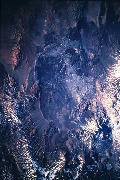
The avalanche and its deposit
The collapse of the northwest flank produced a rock avalanche whose deposit has been estimated by SEGEMAR at 26 cubic kilometres. This figure corresponds to the slid material and should not be confused with the volcanic flows that subsequently re-occupied part of the depression that was opened. The Smithsonian Institution documents domes and flows that partially refilled the affected area, shaping the present relief of that sector.
Dating and chronology of the collapse
The chronology of the event is constrained by two complementary dates: the palaeosol buried beneath the avalanche deposit was dated to between 6200 and 6400 years before present, and the subsequent lavas yield a date of around 5900 years before present. These values correspond to deposits predating and postdating the collapse respectively, and establish a range for the moment of the event without representing its exact date.
Subsurface investigation of the volcano
In 2021 a magnetotelluric survey of Socompa was carried out with the aim of studying electrical resistivity contrasts beneath the volcanic structure. This geophysical technique uses natural electromagnetic fields to characterise the subsurface and was employed as part of an effort to characterise the volcano's internal structure. The results form part of SEGEMAR's technical repository.