
Geology and Structure
The Water Research Commission documents the Skurweberg and Witzenberg ranges as built from durable sandstone, while the Bokkeveld shales of the Agter-Witzenberg valley between them erode more readily, producing the pronounced topographic contrast visible from the passes below. CapeNature identifies resistant Nardouw quartzites specifically in the southern Skurweberg Range of the Bokkeveld, the formation that sustains the upper elevations and shapes the exposed ridge terrain.
The Mountain Club of South Africa recognises Bokkeveld Sneeukop at 2,070 m as a separate high summit within the Skurweberge, distinct from other peaks in the broader range.
Passes and Early Routes
The Ceres Museum records a Mostertshoek crossing through the mountains as early as 1728, and in 1765 Jan Mostert built a toll route through the Breede River gorge. That road was eventually superseded when Andrew Geddes Bain engineered Michell's Pass through the same corridor; Governor Harry Smith formally opened it on 1 December 1848, the same year its tollhouse was constructed.
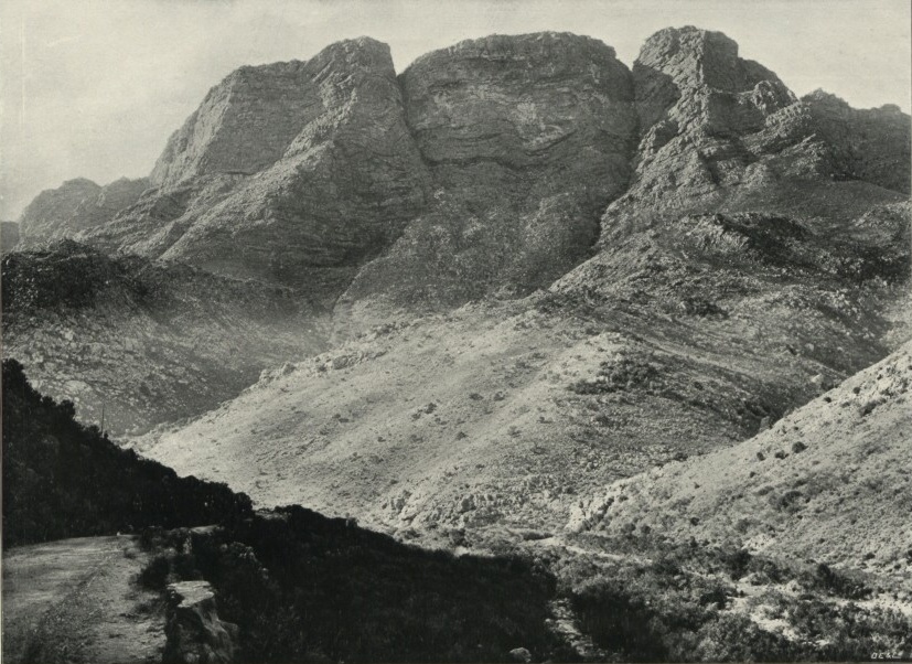
Gydo Pass also opened by the end of 1848, following a separate alignment northward toward the Koue Bokkeveld. Michell's Pass penetrates the range from the south through the Breede River gorge, while Gydo Pass connects toward the plateau country beyond the northern slopes. An E. H. Short photograph from the UK National Archives — catalogued as CO 1069/214/26 and undated — shows the road and rock face of the southern Skurweberge above Michell's Pass near Ceres.
Botanical Record
In December 1891 Harry Bolus collected specimen 1169 of Zyrphelis levis from moist ground at the foot of the Skurweberg near Gydo at a published altitude of 945 m. The collection is cited in a SANBI taxonomic monograph and places the species within the lower fringe of the range near the pass corridor, on ground wetter than the exposed quartzite ridges above.
On 8 November 2014, N. A. Helme collected Ficinia oligantha on the summit area of Bokkeveld Sneeukop, with the catalog recording a collection altitude of 2,030 m, and Carpha schlechteri on its upper south slopes at 1,800 m. The Bolus Herbarium holds these 2014 records. Together, the 1891 Gydo specimen and the 2014 Sneeukop collections span more than a century of botanical documentation across the range's lower approaches and its highest terrain.