
Location and elevation
The Similaun rises as an independent glaciated summit in the Ötztal Alps, set on the border between Austrian and Italian territory. Two recent survey maps give different figures for its summit elevation: a club report of the Austrian Alpine Club from 2018 cites 3,606 m, while a source from 2025 gives 3,599 m — the commonly used approximate value is therefore around 3,600 m. Geographically, the mountain is clearly distinct from the neighbouring ridge with Tisenjoch and Finailspitze; both ridges belong to the same high-alpine area but are topographically independent units.
The Niederjochferner and the Marzelkamm are among the defining glacial and orographic features on the Similaun side. The Niederjoch, situated at approximately 3,019 m, forms the pass where the Similaunhütte stands — one of the oldest mountain huts in this part of the Alps and a traditional starting point for tours into the glaciated high mountains.
The Similaunhütte and its role in 1991
The Similaunhütte at the Niederjoch is not merely an alpine base camp; in September 1991 it unexpectedly stepped into the public spotlight. When an extraordinary discovery was made in the vicinity of the mountain that autumn, it was the warden of the Similaunhütte who alerted the authorities and initiated the first protective measures — a logistical as well as human achievement under difficult high-mountain conditions.
The find itself, however, did not occur at the Similaun or at its summit, but at the Tisenjoch below the Finailspitze, a separate point on the neighbouring ridge. This geographical distinction is essential: the Similaun and its network of huts provide the infrastructural context, not the actual site of the discovery.
Glacial landscape and alpine character
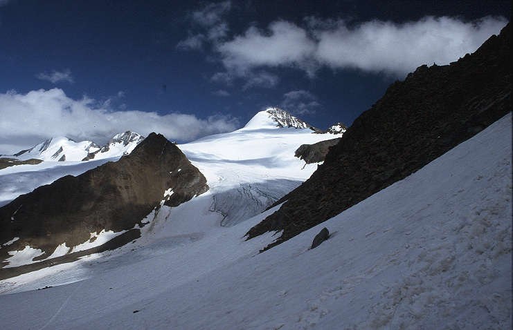
The appearance of the Similaun is decisively shaped by its glacier. The Niederjochferner stretches as an ice field through the terrain below the summit, defining the character of the surrounding landscape as much as the conditions on the ascent. Such Ferner — the term used in Austrian German for the valley glaciers of the Alpine region — are the connecting element throughout the entire Ötztal between the high-alpine summits and the lower trail networks.
The Marzelkamm further structures the relief along the Austrian-Italian border. This combination of ridge, glacier, and pass makes the Similaun a characteristic example of the high-glacial Ötztal topography, in which crossings, passes, and firn have determined the movement routes of people and livestock for centuries.