
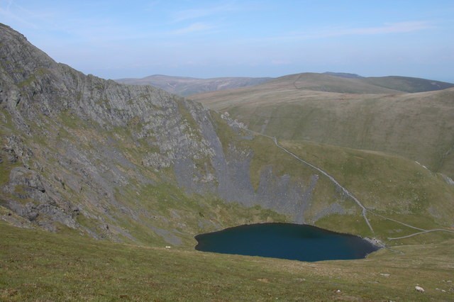
Form and Position
Seen from Scales Tarn, Sharp Edge rises as a narrow elevated crest below Foule Crag. Hallsfell Top, Blencathra's principal summit, stands farther to the west, and the arête connects the tarn basin to the upper crags rather than leading directly to the highest point.
Underlying Rock
The British Geological Survey records the rocks of the Skiddaw Group across Blencathra as deep-water sediments that have been heat-hardened through contact with the Skiddaw granite. The 2026 Keswick Mountain Rescue Team report attributes the slippery polished surfaces on the arête specifically to the Skiddaw slates on Sharp Edge.
Rescue Record
The Keswick Mountain Rescue Team's 2026 report records the first incident on Sharp Edge in January 1961 and five callouts on the arête during 2025 alone, figures it distinguishes from ten incidents recorded across the broader fell in the same period.