
Water Supply and Colonial Acquisition
In June 1924 the colonial government acquired what was recorded as Native Grant 187, a tract of approximately 3,177 acres, for Lautoka's water supply. The Fiji Times documents this history through the testimony of Ratu Wiliame Bouwalu Saumaimuri, who describes the terms of that 1924 land agreement. The Noel Butlin Archives Centre at the Australian National University holds a historical photograph catalogued as Saru Creek near Lautoka dam (AU NBAC 142-3696, undated).
The commissioning of Vaturu Dam in the Nadi highlands in 1982 shifted the region's principal water supply away from the Saru catchment, as reported by the Fiji Times. A small Saru Creek forest reserve, distinct from the broader catchment, appears in Fiji Department of Forestry annual reporting as established in 1973.
Land Returns to Customary Owners
Cabinet agreed in 1999 to return parts of the original grant no longer needed for the public purpose for which they were acquired. On 18 February 2025, Cabinet addressed a specific parcel: a roughly seven-acre forestry experiment station in the cemetery extension area, designated for Mataqali Nadakuvatu. A mataqali is a customary landowning group under Fijian tradition.
In a separate action, the Prime Minister's Office documented a formal title handover to five mataqali in Vitogo — named as Tunuloa, Matarisiga, Vidilo, Nadakuvatu, and Noi Batiri — in a release dated 15 January 2026. The Prime Minister's Office stated that water infrastructure, the cemetery, and essential areas were retained as part of that process.
Landscape and Contemporary Record
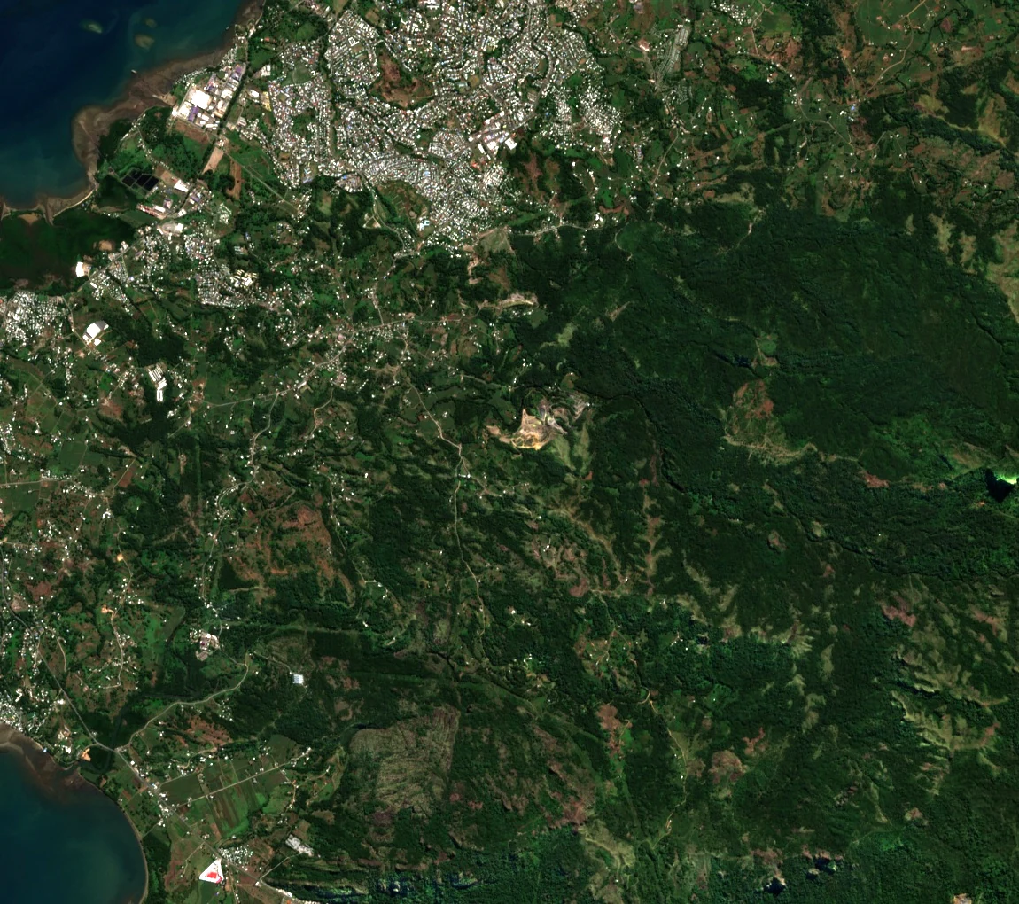
A Sentinel-2B true-colour image captured on 24 June 2026 (UTC) shows Lautoka's outskirts and the foothills of the Saru–Tavakubu catchment as a mosaic of low vegetated ridges and valley corridors immediately inland of the coastal city.