
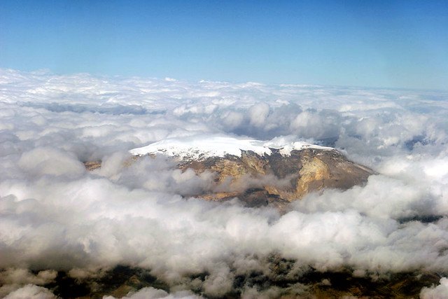
Morphology and position in the Cordillera Central
Santa Isabel occupies an intermediate position in the volcanic chain of the Colombian Cordillera Central, flanked by Nevado del Ruiz and Nevado del Tolima. Its summit groups three volcanic domes and two well-defined peaks, an architecture that reflects magmatic activity accumulated over geological time. The elevation of 4,944 meters is recorded by the Smithsonian Institution in its Global Volcanism Program. The north-south orientation of the glaciated ridge determines the solar exposure of each flank and the rates of melting and accumulation between sectors.
The Conejeras sector and the glaciological mass balance
From 2006, IDEAM measured the glaciological mass balance of Santa Isabel in the Conejeras sector. This parameter expresses the difference between the accumulation of snow and ice and losses through melting and sublimation. In 2009, the World Glacier Monitoring Service incorporated the Conejeras measurements into its international network.
IDEAM attributes the accelerated retreat recorded at Conejeras to several factors: scarce snow accumulation, the relatively low elevation of the volcano for the climatic conditions of the tropical region, and deposits of volcanic ash on the ice surface, which reduced albedo and accelerated melting. In early 2024, IDEAM documented the disappearance of the Conejeras sector as an independent glacial unit, although the ice cover of Nevado Santa Isabel as a whole cannot be considered extinct on the basis of that observation.
The El Hongo sector and the continuity of monitoring
In 2021, IDEAM began monitoring the sector known as El Hongo, another sector of the Santa Isabel ice cover. Unlike Conejeras, El Hongo remains under monitoring, making it possible to maintain field measurement series on the névado.
The methodology employed by IDEAM for both sectors follows glaciological mass balance field standards, combining direct measurements on the ice with records from the accumulation and ablation zones. The series begun at Conejeras in 2006 and the ongoing monitoring of El Hongo since 2021 constitute the available record of the evolution of Santa Isabel's ice cover.