
Granite Foundations and a Shaped Coastline
The headlands flanking Saldanha Bay's deep-water entrance are made up of intrusive granite belonging to the Darling suite, dated by geological survey to approximately 500 to 550 million years ago. This hard rock forms the promontories on both sides of the channel. Former wave-cut bedrock platforms exposed at several points along the shore record past positions of the shoreline. Younger shell-bearing dune sediments blanket parts of the same terrain, and the two materials are distinct in origin and should not be treated as the same deposit.
The hills visible from the town, including the ridge that carries the Adam and Eve vertical outcrops, rise above the harbour front and are identified in municipal planning as Hoedjieskoppie. Hoedjiespunt is a separate peninsula within Saldanha Bay, with its own lower topography and fossil formations. The rocky outcrops of each feature are distinct localities as defined by the municipality.
Hoedjiespunt and the Evidence from the Fossil Dunes
At HDP1, on the southern edge of Hoedjiespunt peninsula, excavations exposed a fossil dune formation sitting on a wave-cut platform roughly 12 to 15 metres above modern sea level. That platform records a former shoreline position. The 1995 field report by Berger and Parkington recorded human teeth from these deposits and noted a capping calcrete layer. Uranium-series analysis established a lower bound of 74,000 years on the age of the material. The same report proposed a considerably older depositional age on the basis of fauna and stratigraphy, though that estimate is inferential rather than directly dated.
Coastal fieldwork published in 2015 by Will and colleagues examined both Hoedjiespunt and Lynch Point, documenting shellfish remains and stone artefacts at both locations. The findings confirm episodes of coastal foraging at the peninsula. The fossil layers and the later shell accumulations represent different episodes and different classes of evidence.
Hoedjiesbaaikoppie and the Urban Hill
Hoedjiesbaaikoppie is the hill within the town boundary of Saldanha. In November 2014, Saldanha Bay Municipality produced a formal Local Area Plan for the area. That planning document identified a cluster of historic fishing cottages and a fishing museum at the hill's foot as the core of a proposed heritage precinct. It recorded that the district's history encompasses both the fishing industry and apartheid-era forced removals as subjects the precinct would interpret.
The 2014 plan proposed path connections between the coastal edge and the hill, along with a framework for heritage interpretation. The 2015 to 2016 municipal Integrated Development Plan reviews describe the history of the port and its neighbourhoods, placing the heritage work within a wider account of the harbour town's spatial and economic development.
A Harbour Seen Whole
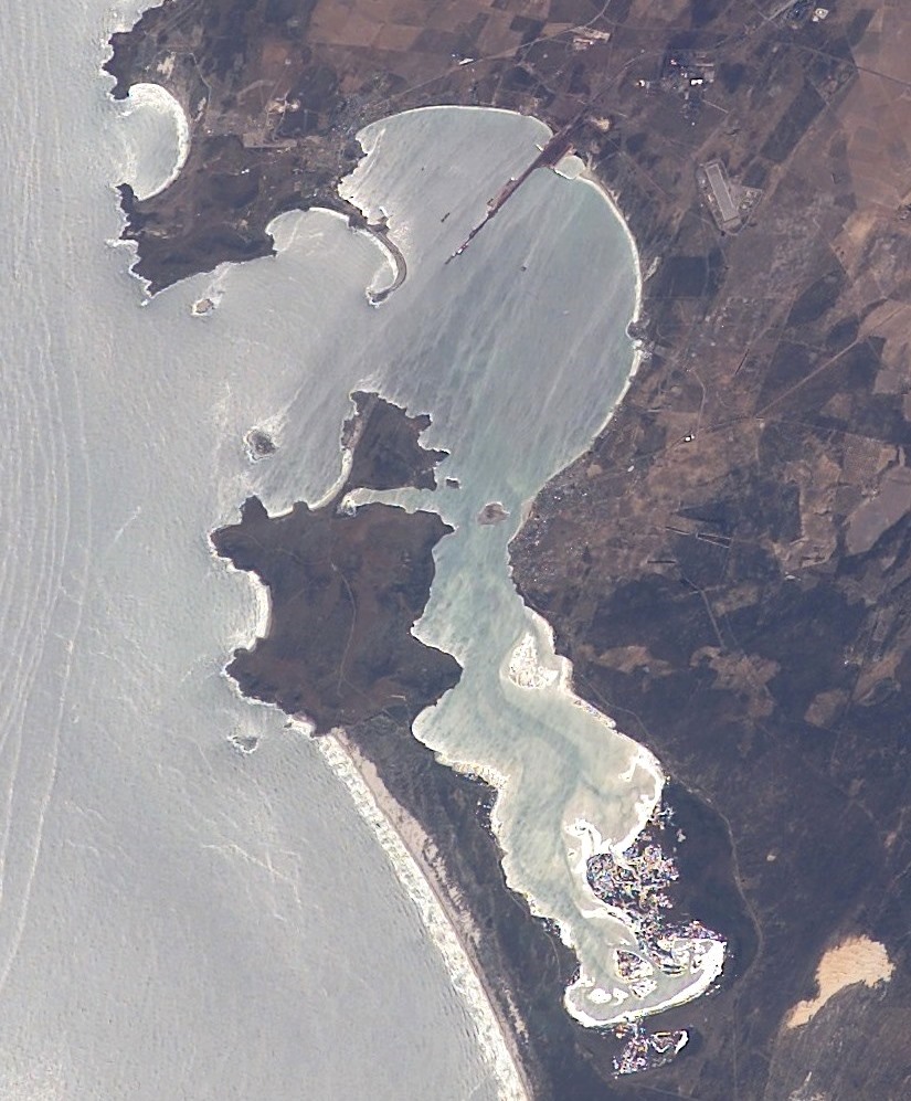
The NASA astronaut photograph taken on 9 March 2003 from the International Space Station, catalogue reference ISS006-E-37018, shows Saldanha Bay, Langebaan Lagoon, and the hills along the shore as a continuous landform. The bay and the lagoon are distinct water bodies, and the hills running between and around them are visible in relation to both. At ground level the terrain resolves into separate components: the granite ridge above the town, the lower Hoedjiespunt peninsula, and the dune-covered flanks between them. No surveyed summit elevation for the hills has been confirmed in the available sources.