
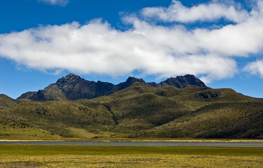
Morphology of an ancient volcano
The caldera crowning Rumiñahui expresses its identity as an ancient volcano in the park's high-altitude landscape. The flanks show the transition described by the Pichincha provincial tourism office: the páramo grassland gives way to rocky ridgelines as the terrain steepens, and the gully defines the upper profile of the massif. That succession of environments, from páramo vegetation to bare rock, articulates the relief readable from the volcano's base.
Limpiopungo lagoon as a reference for the relief
Limpiopungo lagoon occupies a depression in the high Andean plain at the foot of the massif and forms, together with the surrounding grassland, the highland setting recorded by Ecuador's Ministry of Tourism. From its shore, the flanks of Rumiñahui take on scale: the sheet of water reflects the profile of the ridgelines and allows the difference in relief between the plain and the caldera's elevation to be appreciated. The lagoon thus serves as a geographic reference point as defining for the massif as the summit itself.
A stratovolcano in the context of the park
Rumiñahui shares the protected area with other volcanic summits in the park. Its character as a Pliocene or Pleistocene structure places it on an extensive timescale of volcanic activity along the cordillera, and the profile it traces above the Limpiopungo plain makes it a recognizable feature of the high Ecuadorian sierra landscape.