
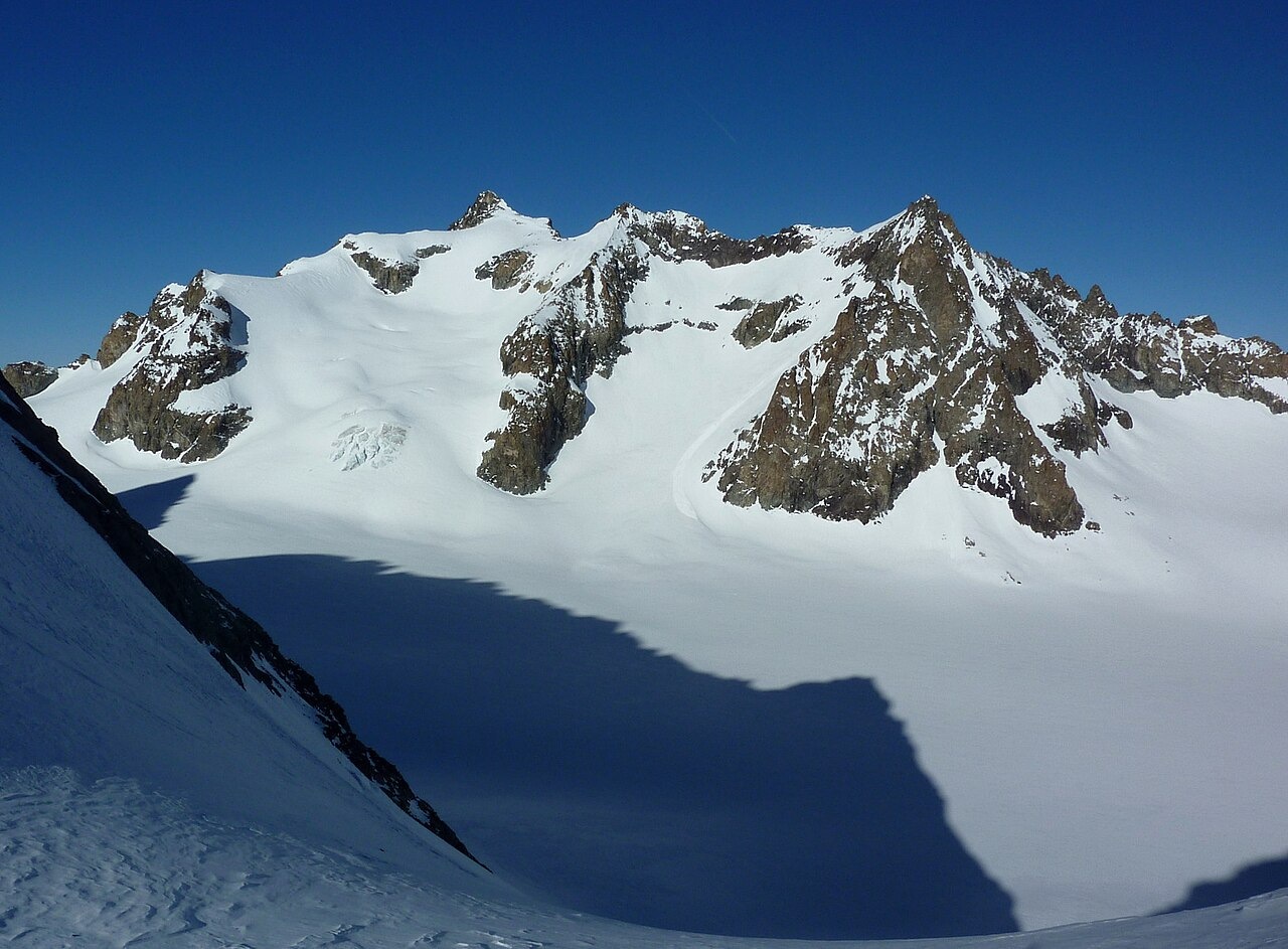
A Ridge of Gneiss and Partial Melting
Field mapping by Maurice Gidon of Université Grenoble Alpes traces the Roche Faurio ridge as the northwest boundary of the upper Glacier Blanc basin. The rocks composing much of this regional crest belong to the Lavey type — gneisses that have undergone partial melting, a process that alters both the structure and the mineral composition of the original rock. Gidon maps a band of anatexites, rocks produced or altered by that partial melting, running through the ridge zone.
That same band of anatexites underlies the small southern glacier on the Roche Faurio side of the crest and also supports Glacier de Tombe Murée, which occupies north-facing cliffs, together forming a partially melted rock strip mapped by Gidon. Glacier de la Plate des Agneaux lies on the northern aspect of the ridge. The photograph taken on 9 February 2011 by Frédéric Bunoz shows Roche Faurio on the left and the adjacent Pointe Louise on the right, with Glacier Blanc filling the foreground below, clarifying the spatial relationship between the summit and the glacier basin it bounds.
1873 Summit and 1874 Col Crossing
In his firsthand account "The Dauphiné in 1873," published in Alpine Journal volume VII, Frederick Gardiner described a June 1873 ascent of Roche Faurio. His party camped alongside the Glacier de la Bonne Pierre during reconnaissance, made an early start the following morning, and climbed by alternating snow gullies and rock to regain the ridge crest. Gardiner recorded a memorable view back toward the Écrins from the summit. During the climb one member of the party dropped a pocket-book that caught on a rock ledge and was later retrieved.
Col de la Roche Faurio is a distinct pass farther along the same glaciated crest, with its own climbing record. The Alpine Journal documents the first crossing by C. Taylor and R. Pendlebury, accompanied by guide Gabriel Spechtenhauser, on 1 July 1874. That crossing linked Glacier de la Plate des Agneaux and Glacier Blanc, a year after the peak itself had been reached.
Measured Ice Loss on Glacier Blanc
Between 2014 and 2019, Écrins National Park and INRAE conducted a lidar monitoring programme on Glacier Blanc using repeated airborne laser scanning. By comparing successive elevation models derived from those scans, researchers estimated height differences across the glacier surface over time. The surveys recorded an average loss of approximately 6.8 metres of ice thickness across Glacier Blanc during that period. In the hollow directly below Col de la Roche Faurio, the localised thinning reached approximately 12 metres — roughly twice the glacier-wide average — and the terminus of Glacier Blanc retreated by approximately 300 metres over the same years.
Ground-based frontal measurements, carried out independently of the airborne campaign, corroborated the approximately 300 m retreat reported by the park. Annual mass-balance assessment of Glacier Blanc began in 2000, establishing a continuous record of accumulation and loss. The Glacioclim national observation network added Glacier Blanc to its programme in 2018. These thickness and retreat figures describe Glacier Blanc specifically. The smaller glacier on the opposite side of the Roche Faurio crest is a distinct body of ice and is not part of the same measurement record.