
Location and boundaries
The Roccia Nera lies on the border between Italy and Switzerland, in the Monte Rosa group of the Pennine Alps. Its geographical position is precisely defined by the local topography: the Breithorn lies to the west and Pollux to the east. The col separating the Roccia Nera from Pollux is the Schwarztor, situated at 3,725 metres. This position as a pass and ridge junction makes the mountain a node in the system of cols and crests connecting the major summits of the eastern Breithorn sector, and explains why it is commonly — if not exclusively — associated with the Breithorn group.
Three names for a border summit
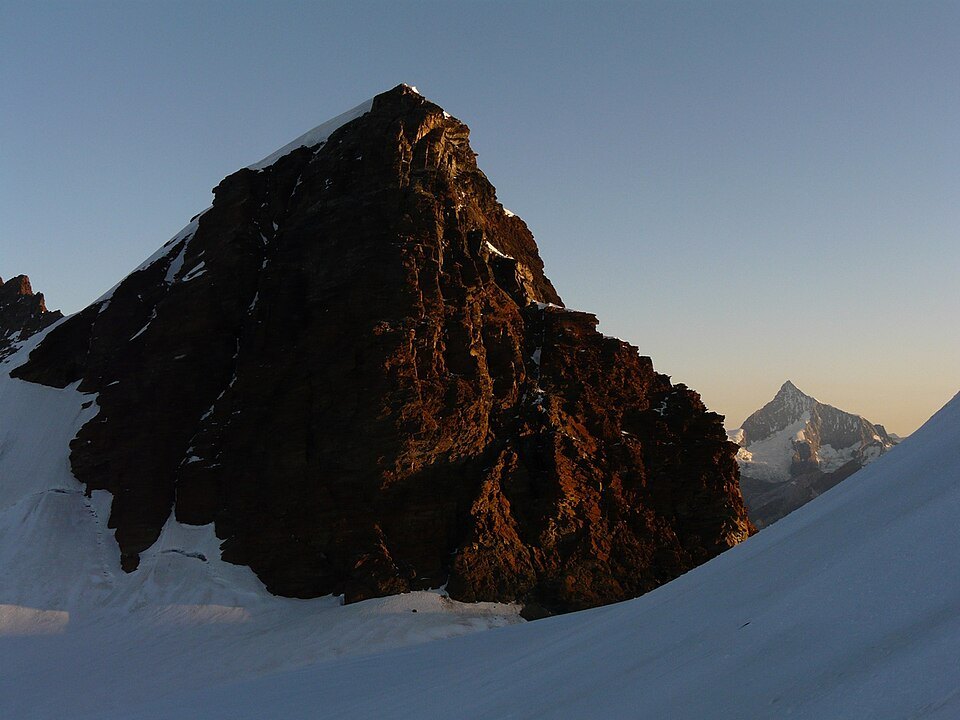
The fact that the mountain bears distinct names in Italian, French and German — Roccia Nera, Roche Noire, Schwarzfluh — reflects its position as a border in both a geographical and cultural sense. All three forms translate the same chromatic and material description: a dark-coloured rock, an element that presumably characterises the visual appearance of the summit in contrast to the snowy and glacial faces of the surrounding massif. The coexistence of three names is a sign of the historical overlap of Walser, Franco-Provençal and Italian communities that have inhabited and frequented the high valleys at the foot of this sector of the Pennine Alps.
The north-east face and the route opened in 2017
On the north-east flank of the Roccia Nera a climbing route was opened in September 2017, extending over 450 metres. Reporting describes it as one of the most difficult mixed routes in the entire Monte Rosa massif, with sections graded at 8b-. It is a route for highly experienced alpinists. It should be noted that, since the first ascent, no documented repeat has been recorded: consequently the stated difficulty has not yet been confirmed by subsequent ascents, and the grade remains to be verified.
This aspect — a technically extreme route opened in recent times, with only a single ascent to its name — gives the north-east face of the Roccia Nera a particular status in the landscape of modern alpinism on Monte Rosa: not a consolidated and frequented route, but an itinerary still in the exploratory phase, whose true character is still being assessed by the climbing community.
Within the Monte Rosa system
At 4,075 metres, the Roccia Nera is one of the UIAA-recognised 4,000-metre summits of the Alps, included among the significant peaks of the Monte Rosa group. Its elevation, lower than that of the massif's principal summits such as Punta Dufour or Punta Zumstein, does not diminish its morphological significance: the summit represents instead one element of the complex system of ridges, cols and faces that makes Monte Rosa one of the most articulated and studied massifs in the Pennine Alps.