
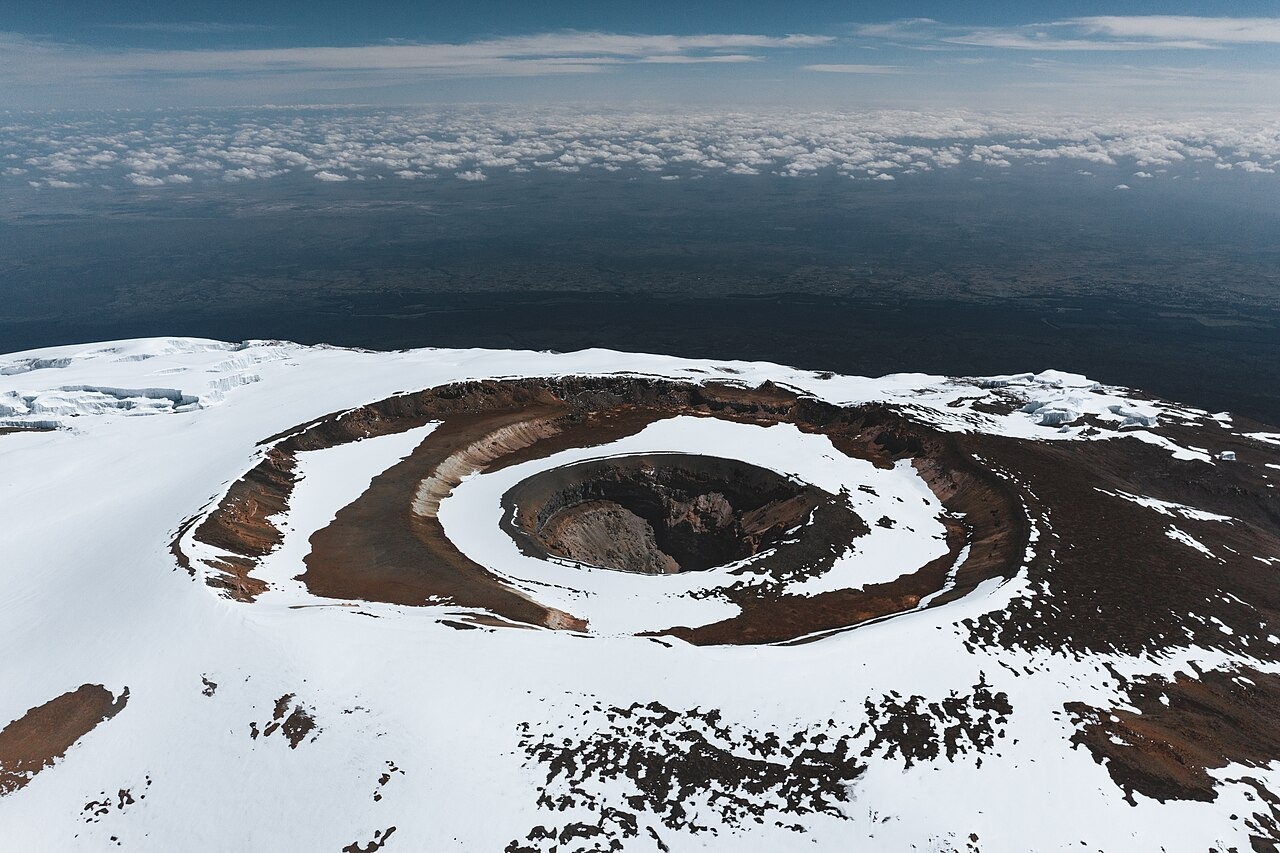
Nested Landforms of the Kibo Caldera
The Kibo summit presents a sequence of nested volcanic features visible from the crater rim. The broad outer caldera gives way to the inner crater, which field observers have described as an interior cone with its own distinct depression. Within that inner crater, the Ash Pit forms the smallest of the concentric features. The Smithsonian Global Volcanism Program records the Ash Pit coordinates as 3°3′53″S 37°21′31″E at 5,760 metres.
Volcanic Age and Summit Crater Formation
K–Ar dating reported in the Journal of Volcanology and Geothermal Research places the evolution of the present summit crater at approximately 200,000 to 150,000 years ago. That age range applies to the development of the crater system as a whole rather than to any single interior feature. No confirmed eruption date is recorded in the historical period, and the volcano has not produced documented eruptive activity in written accounts.
Richard Reusch, Guide Oforo, and the 1927 Visits
The crater takes its name from Richard Reusch, whose ascents are documented in the Alpine Journal. The chronology recorded there places Reusch at the summit with his guide Oforo on 17 July and again on 14 October 1927. Active fumaroles within the Ash Pit area have been observed on subsequent expeditions, indicating residual geothermal activity consistent with the Smithsonian's classification of Kilimanjaro as a dormant volcano.