
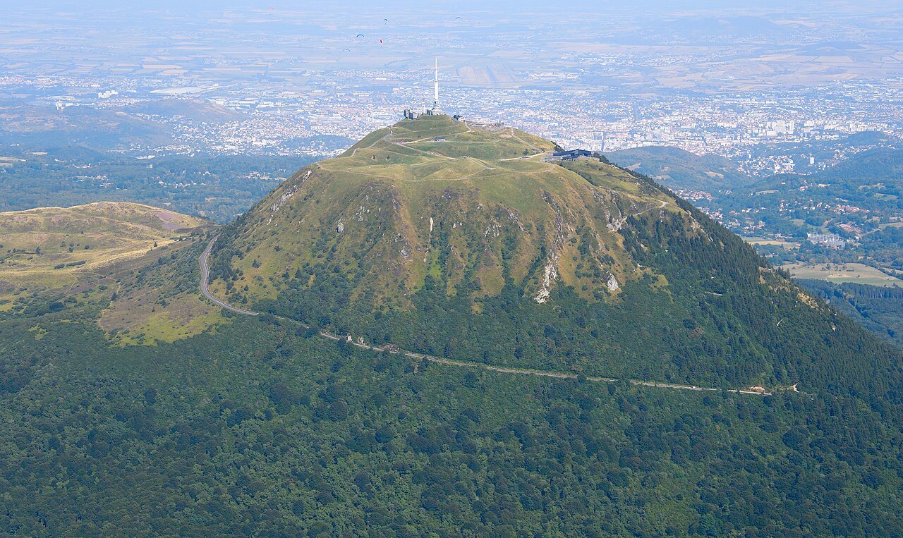
A dome among the craters
At 1,465 metres, the Puy de Dôme rises above an alignment of volcanoes whose forms differ within a few kilometres of one another. At the Pariou, the eye looks down into a crater. On the Dôme, lava too viscous to flow far accumulated near its vent and gave the summit its domed profile.
The relief can also be read by looking eastward. Beyond the plateau, the escarpment of the Limagne fault marks the transition to the plain of Clermont-Ferrand. UNESCO inscribed the volcanic chain and the fault together in 2018. From the summit, it is possible to situate the volcanoes within the landscape shaped by the opening of a rift across the Massif Central.
The pilgrims' ascent to Mercury
In the 2nd century, a terraced sanctuary occupied the top of the volcano. It was dedicated principally to Mercury, protector of travellers and merchants. For pilgrims, the ascent began near the Via Agrippa, which linked Lyon to Saintes by way of the Col de Ceyssat.
The Chemin des Muletiers today follows this same relationship between the col and the summit. Along its switchbacks, the terrain conveys what the pilgrimage represented: a journey from a major road of circulation up to a sanctuary perched above the plateau. The remains and the interpretation centre allow visitors to place the terraces and access routes within the organisation of the temple.
The mercury column of 19 September 1648
At the request of Blaise Pascal, his brother-in-law Florin Périer compared the height of mercury in a tube at Clermont and at the summit of the Puy de Dôme. The column was lower at the top. The difference made measurable the decrease of atmospheric pressure with altitude.
The Puy de Dôme offered a very practical advantage for the experiment. The same instrument could be carried from the town to the summit in a few hours, with a sufficient difference in altitude to make the effect clearly visible. The change in elevation felt while walking became, in Périer's account, a means of measuring the weight of air.
From the col to the summit plateau
From Ceyssat, the Chemin des Muletiers concentrates the ascent in switchbacks up the flank of the dome. The rack railway of the Panoramique des Dômes climbs from the foot of the volcano. Both approaches lead onto the same plateau, where views to the north and south help trace the alignment of the puys. The Grand Site indicates access conditions and the state of the trails.