
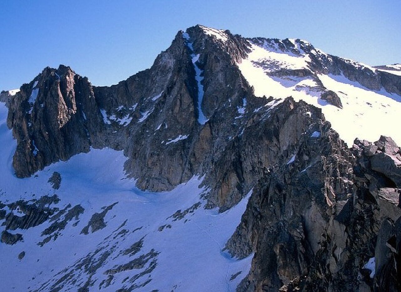
Granite Ridge and Survey Geometry
The Spanish National Geographic Institute's geodetic triangulation sketch, referenced from the Micéu station, distinguishes Punta de Astorg from adjacent summits along the ridge, including Pico del Medio at 3,349 metres as confirmed by the 2020 Aragon gazetteer. The Geological and Mining Institute of Spain's Benasque geological sheet characterises the summit rock of the high Aneto-Maladeta group as medium-grained granite containing biotite, muscovite, cordierite, and conspicuous feldspar. Within the regional granite, a network of joints is lined with black tourmaline needles.
The Posets-Maladeta Natural Park records moraines, cirques, and tarns as characteristic landforms of the glacially shaped high terrain. The Aneto Glacier lies to the north and northeast of the ridge.
Le Bondidier's 1905 Traverse
In his 1907 memoir Un mois sous la tente, the mountaineer Louis Le Bondidier described a crossing on 3 August 1905 from a camp in the Llosás area that included what he characterised as the first ascent of Pico Maldito and the second ascent of Punta de Astorg, along with Pico del Medio, the Coronas, and Aneto on the same outing. His account, passages of which are preserved in the Virtual Library of Aragon, recalled that through a notch in the ridge the Maladeta could be made out. He attributed an earlier ascent of the north side to René d'Astorg and Henri Brulle, crediting the account to Beraldi.
In his account of a 1905 outing, Le Bondidier recalled that René d'Astorg and Henri Brulle had reached the summit by way of the north flank, identifying it as a higher point on the ridge. The present official map recognises Punta de Astorg and Pico Maldito as separate named points on the closely packed ridge, and the photograph from Aiguille Juncadella shows the two distinctive summits in clear juxtaposition.
The Aneto Glacier and Its Measured Retreat
The Aneto Glacier, a major ice body of the Pyrenees, lies below the ridge to the north and northeast of Punta de Astorg and has been the subject of repeated scientific measurement. A 2023 study by Vidaller and colleagues published in The Cryosphere reconstructed its extent using historical aerial photographs, airborne LiDAR, and repeated uncrewed survey flights. The glacier's terrain surface area declined from 135.7 hectares in 1981 to 48.1 hectares in 2022, a reduction of 64.7 percent over that period. The lowest front of the glacier rose from 2,828 metres in 1981 to 3,026 metres in 2022.
The 2023 study recorded that the Aneto Glacier split into two distinct bodies between 2015 and 2016, and that a small proglacial lake had appeared in front of the retreating glacier by the end of the 2022 series. The surrounding terrain combines moraines and glacially eroded bowls that give additional evidence of a longer ice history across the massif, as documented in the park inventory.