
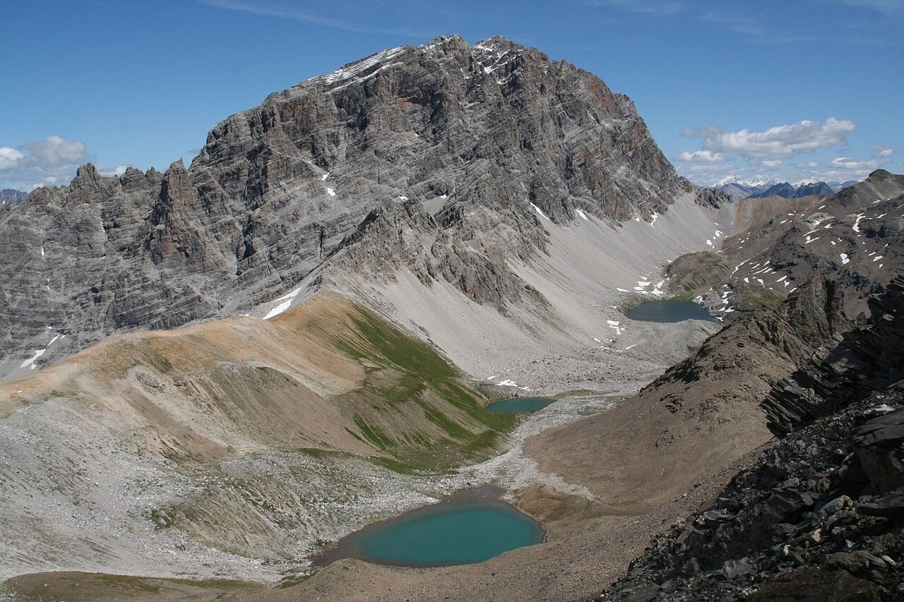
A Peak That Names a Park
The relationship between Piz Ela and Parc Ela is one of naming and identity. The regional natural park takes its designation directly from this summit, establishing the peak as a kind of geographic anchor for a landscape that stretches across the Albula and Surses districts. At roughly 3,339 metres, the mountain does not rank among the highest points of the Swiss Alps, but its role as the symbolic centre of the park gives it a significance beyond raw altitude. Parc Ela is among the larger nature parks in Switzerland, and the summit provides a fixed point from which the park's varied terrain — forests, gorges, and high pastures — radiates outward.
Dinosaur Tracks Near the Summit
In 2009, fossil dinosaur tracks were discovered in the vicinity of Piz Ela's summit, according to official park reporting. The tracks are preserved on what was once a sediment surface — a former ground level that has since been lifted, folded, and reoriented by the forces that built the Alps. The park associates traces from this region with a period of approximately 200 million years ago, though that figure represents a scientific approximation rather than a precise date, and the year 2009 refers specifically to the discovery, not the age of the material. The reporting does not attribute the tracks to a named species, and it would be a misreading of the evidence to suggest that the entire mountain's rock sequence bears similar markings.
Rock Formed Before the Mountains
The existence of these tracks offers a concrete way to understand the deep history embedded in Alpine relief. The sedimentary beds near Piz Ela's summit were laid down in a low-lying environment — most likely a coastal or alluvial plain — at a time when the landmass that would become central Europe bore no resemblance to its present form. The subsequent collision of tectonic plates compressed and elevated these layers, eventually placing a former ground surface at more than three thousand metres. Piz Ela's summit is therefore not simply a high point in a modern landscape; it is a stratigraphic document, with the dinosaur tracks serving as a legible entry in that record.