
Ridge, Saddle, and Summit Form
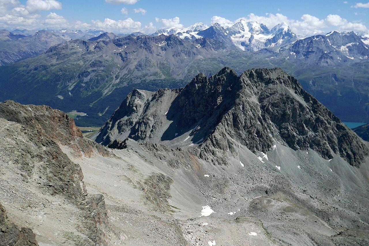
The Swiss name map places the summit of Piz Albana at around 3,100 metres within the municipality of Silvaplana. The Fuorcla Albana, a pronounced saddle at the base of the upper rocky slopes, connects Piz Albana to Piz Güglia — also known as Piz Julier — which stands higher to the northwest.
A photograph taken from the Fuorcla Albana looks up toward the rocky slopes of Piz Albana, where a well-defined brow rises above loose rock flanks, with the col itself forming the immediate foreground between the two summits.
Porphyry Dykes and a Contested Geological Boundary
The Swiss Geological Atlas St. Moritz sheet records rhyolite porphyry dykes in the zone between Piz Julier and Piz Albana, associated with alkaline granite intrusions in the surrounding bedrock. The atlas distinguishes two varieties: a pale greenish compact form whose quartz phenocrysts appear as individual crystals set within a finer groundmass, and a darker brown form with greater susceptibility to weathering.
The same atlas notes that tracing the boundary between the Julier and Err nappes becomes difficult east of Piz Albana, where older maps drew differing boundaries along the same ground. The atlas recorded crushed gneiss near granodiorite contacts toward the foot of Piz Albana Pitschen, a feature less apparent in the terrain toward Champfèr.
Organized Guiding and the Mountain in the 1870s
A first-person account in the Swiss Alpine Club journal from the 1870s records an ascent of Piz Julier and describes Piz d'Albana — the name in use at the time — as a brown-rocked face on the side of a steep bowl that lies below the rocky ridge linking it to neighbouring Piz Julier. The account also notes workmen making a path on the scree below Piz Julier.
The same journal account records the formation of a Silvaplana mountain guides' association in 1877, with its office established at the Hotel Riv'Alta in the village, and notes that the association's tariff for a guided ascent of Piz Julier was lower than the rates charged by guides operating from St. Moritz or Pontresina.