
Geology of the Grey Mare Granodiorite
The Grey Mare Range and its southward continuation, Reads Spur, form an elongate granodiorite spine enclosed within the Geehi Metamorphic Complex. E. den Tex and colleagues carried out field mapping across this body in late summer 1956 for the Snowy Mountains Hydro-Electric Authority, and presented their findings in December of that year. Their 1959 paper in the Proceedings of the Royal Society of Victoria maps The Pinnacle by name and shows the ridge in geological cross-section. They identified quartz, plagioclase, and biotite within the gneissic granodiorite, along with distinctive dark rock inclusions, and their mapping discussed how differential weathering of these rock types produces the range's topographic character.
The survey found that Grass Flat Creek and Ramages Creek had cut deep into weakened rock along shear zones. The granodiorite forms the spine of the ridge. The surrounding Geehi Metamorphic Complex weathers more deeply in many places.
Glacial Limits and Periglacial Landforms
An early regional interpretation attributed many high-country features in the Snowy Mountains to Pleistocene glaciers. A. S. Ritchie and J. N. Jennings reported on their field survey of the Grey Mare Range in July 1955 and published it in 1956, concluding that the range escaped most of the glaciation clearly recorded on the higher Main Range to the east. Their field observations left room for only two possible small cirque glaciers on the Grey Mare Range,.
The shape of a hollow or gully alone can be misleading. In their survey, Ritchie and Jennings considered erosion by streams and weathering under cold conditions as explanations for features previously attributed to ice.
Ridge Traverse, Mining History, and Country
In the 1935 Australian and New Zealand Ski Year Book, a contributor writing as Kiandra described ski tours from the Grey Mare Mine shelter. The account gave The Pinnacle a height of 5,100 feet and described the descent along Reads Spur to Geehi Hut. Elsewhere in the range, prospectors found alluvial gold in the Bogong workings in 1894 and located the reef in 1895. Work at Grey Mare revived in the mid-1930s. The 1949 Grey Mare Hut was the third mining shelter at that site.
Wiradjuri, Wolgalu, Ngunnawal, and Monaro Ngarigo peoples hold ongoing connections to Country across Kosciuszko National Park, documented by NSW National Parks and Wildlife Service, and the landscape was known and traveled long before European prospectors reached the Grey Mare workings. In the broader Geehi catchment, workers completed Geehi Dam and the underground Snowy–Geehi Tunnel in 1966. The tunnel brings water from Island Bend toward the Murray power stations as part of the Snowy Mountains Scheme.
Elevation and Mapping Record
The Composite Gazetteer of Australia records Pinnacle Mountain (NSW_44494) on the western side of the ridge. The Copernicus digital surface model puts the crest at about 1,580 metres, close to the roughly 1,550 metres in the 1935 Ski Year Book.
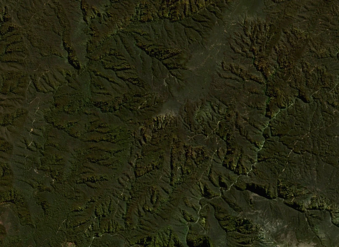
A north-up true-color Sentinel-2 image acquired on 8 September 2026 shows Pinnacle Mountain with the summit just above centre, forested slopes descending along the southern Grey Mare Range, and the Geehi valley incised deeply to the east. The 2010 NSW Scientific Committee regional field map labels The Pinnacle independently of the gazetteer record and separately from the summit positions of Mounts Townsend and Kosciuszko on the higher Main Range to the southeast.