
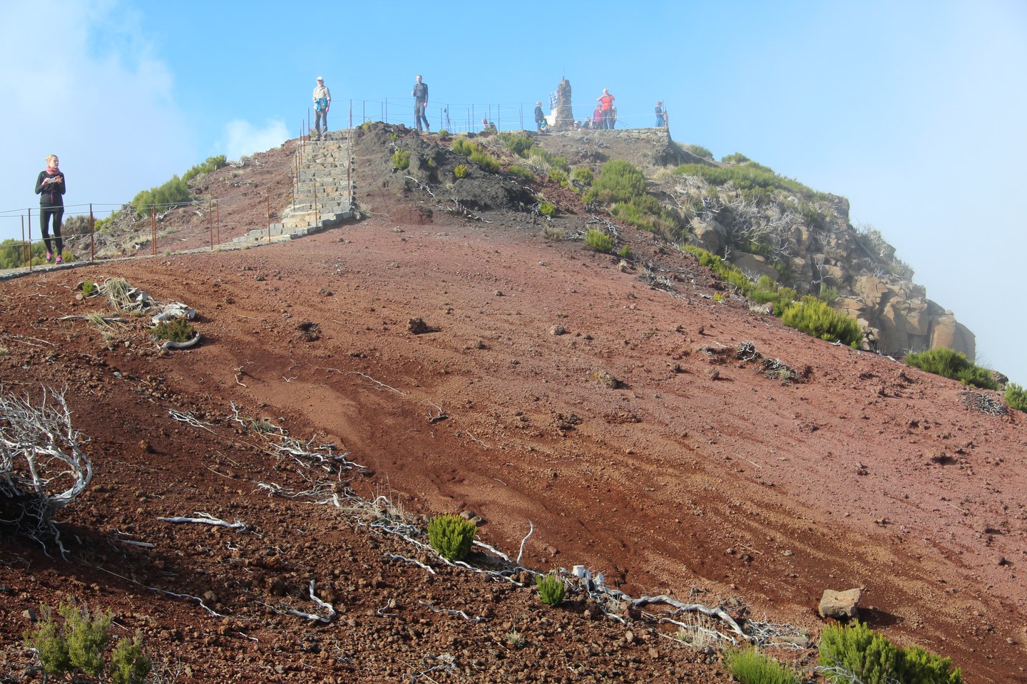
Geology and Relief
The sharply dissected form of Madeira's central massif results, according to the Visit Madeira agency, from differential erosion of pyroclastic rocks by water. This is not the product of recent volcanic activity, but of the patient work of water on explosive-origin materials of varying resistance, which has carved the escarpments and deep valleys that define the whole today. The Natural Monument of the Central Mountain Massif covers approximately 8,200 hectares, including elevations above roughly 1,400 metres, and extends from the highest eastern peaks to the Paul da Serra plateau in the west.
It should be noted that the Pico Ruivo discussed here — the highest point on the island, located in Santana — is a distinct formation from Pico Ruivo do Paul, a peak of the same name situated in the western part of the range. Confusion between the two place names is possible, but their geographical and altimetric contexts are entirely different.
Panorama and Summit Vegetation
From the summit, in good visibility conditions, the Visit Madeira agency describes a panorama taking in Curral das Freiras, Câmara de Lobos, and the valleys of Ribeira Grande and São Jorge. On days of exceptional clarity it is possible to sight the islands of Porto Santo or the Desertas, testament to the isolated Atlantic position this viewpoint occupies. The vegetation colonising the highest elevations of the summit is dominated by high-altitude heather, adapted to the wind and temperature conditions characteristic of these 1,862 metres.
The massif has been identified as a nesting area for the Zino's petrel, an endemic bird whose conservation status lends added ecological significance to the natural monument as a whole, although nesting records refer to the massif in general and not specifically to the summit of Pico Ruivo.
Paths and Forest Transition
The PR1.2 trail, described in IFCN documentation, connects Achada do Teixeira to the summit of Pico Ruivo, forming one of the access routes to the island's highest point. From the summit shelter, the descent towards the parish of Ilha passes through a marked landscape transition: from heather and high-altitude vegetation, there is a gradual shift to the native laurisilva forest, characterised by moisture and dense canopy cover. This passage between two distinct botanical worlds is one of the most documented experiences on the massif's walking routes.