
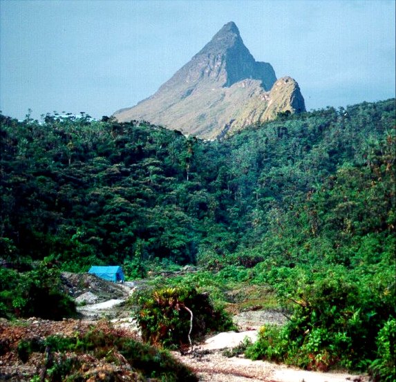
Yaripo: the mountain of the Yanomami
For the Yanomami people, the mountain is known as Yaripo. According to ICMBio, the Yanomami understand it as the House of Spirits — a designation that expresses this people's profound cultural and cosmological bond with the territory, and which should be understood as such, not as the literal translation of a geographically verifiable name. This meaning gives the mountain a dimension that transcends topography: it is a central symbolic reference in the lives of the communities that have inhabited its region for centuries.
The overlap of two protected areas reflects this duality. Parque Nacional do Pico da Neblina was created in 1979, and the Yanomami Indigenous Territory was demarcated in 1992. Together, these protections establish an arrangement in which environmental conservation and indigenous territorial rights formally coexist — a model that continues to be the subject of shared management between ICMBio and Funai.
Geology and flora of the tepui
Pico da Neblina is a tepui within the Pantepui region — a zone of plateaus and rocky massifs extending across the Guiana Shield through Brazil, Venezuela, and Guyana. This ancient geological origin, combined with the isolation imposed by altitude, created conditions for the emergence of endemic flora. ICMBio records, in the mountain's highland campos, the presence of Bonnetia neblinae, a plant species found nowhere else on the planet — an indicator of the biological uniqueness of this environment.
The mists that frequently shroud the flanks of the mountain — and that most likely inspired its Portuguese name — are part of the climatic conditions characteristic of the tepui. The constant humidity, high altitude, and rocky substrate of the Guiana Shield shape a transitional ecosystem that has no equivalent in the Amazonian lowlands that surround it.
Shared governance and indigenous leadership
In 2026, Funai signed a letter of consent relating to the Yaripo Visitation Plan, an instrument that assigns indigenous organizations a leading role in the management of community-based ecotourism on the mountain. The plan provides for the joint participation of ICMBio, establishing a governance structure in which decisions about access to the territory necessarily pass through the consent and authority of the Yanomami communities.
This governance architecture represents a convergence between federal environmental policies and indigenous rights: the highest mountain in Brazil is also a territory where the protection of nature and the self-determination of a people are intertwined in an institutionalized form. The Yaripo Visitation Plan is, in this context, a document that formalizes Yanomami leadership over the use and interpretation of their own territory.