
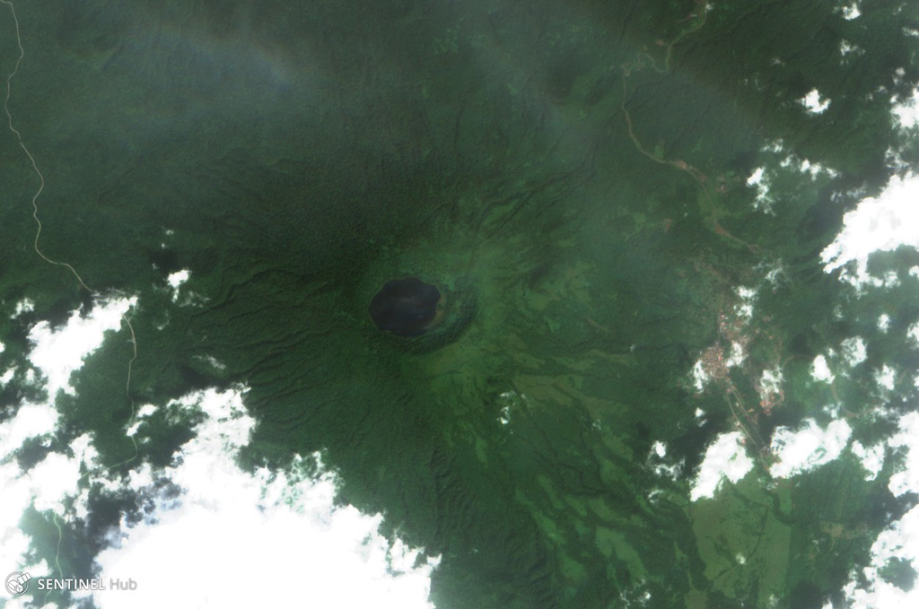
A Forested Caldera Visible from Orbit
A Sentinel-2 image from 26 December 2017 shows the dark lake and the forested walls of the caldera. The depression is about 1.5 kilometres across; the lake occupies only part of it. North is at the top.
Pico Biaó is one of several volcanic centres on Bioko that form part of the Cameroon Volcanic Line, a chain of alkaline magmatic features extending across both oceanic and continental crust. The island setting places the volcano in the Gulf of Guinea, separated from the Cameroon mainland by open water.
What Scientists Found When They Measured Lago Biaó
On 5 and 6 January 2002, Schabetsberger and colleagues sampled Lago Biaó as part of a limnological study published in Hydrobiologia in 2004. At their study site the lake reached a sounded depth of 18.5 metres. They measured water transparency using a Secchi disk — a white disk lowered until it disappears from view, giving an index of how far light penetrates — and recorded visibility of 5.5 metres. Dissolved oxygen saturation at the time of survey fell from 90 percent at 6 metres depth to 27 percent at 10 metres, indicating sharp stratification in the water column.
The same January 2002 survey also covered nearby Lago Loreto, whose profile contrasts markedly with Lago Biaó's: Loreto reached 82 metres in depth, while Secchi disk transparency measured only 0.6 metres under those survey conditions. These figures belong to each respective lake as recorded during that single survey period and do not represent year-round or current water quality.
A Highland Plant and the Barriers Between Peaks
A 2021 study by Pérez-Pérez and colleagues examined Lobelia columnaris — a tall, columnar lobelia — across the high-elevation massifs of West Central Africa, documenting the species at the Pico Biaó–Moka area of Bioko (Figure 2 of that publication). The researchers compared chloroplast DNA samples from multiple sites. Their analysis grouped the southern Bioko populations, drawn from Biaó and Luba, separately from populations on northern Bioko and on the Cameroon mainland.
The authors interpret this genetic separation through the concept of sky islands: higher-elevation habitats function as ecological islands, surrounded below by lowland habitat and, between Bioko and the continent, by open sea. Those lowland zones and the sea channel act as barriers that limit gene flow between populations living on separate peaks. This result concerns one sampled species, Lobelia columnaris, and does not generalise to the whole flora of the region.