
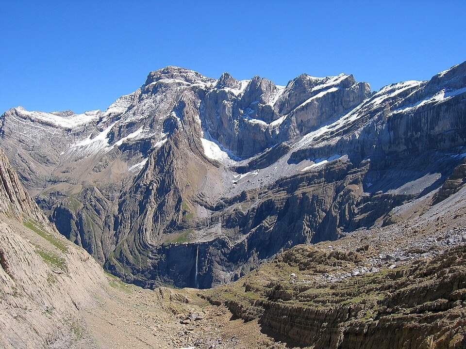
A summit at the junction of two national parks
The Pic de Marboré holds an institutional as much as a geographical position: it is one of the summits that dominates the Cirque de Gavarnie from the border ridge, and it marks in altitude the boundary between two of the most important national parks in the Pyrenees. On one side, the Parc national des Pyrénées, established in France; on the other, the Parque Nacional de Ordesa y Monte Perdido, in Spain. These two areas together form a protected cross-border ensemble of which the Pic de Marboré is one of the topographic reference points.
This dual membership in the Monte Perdido massif and the environment of the Cirque de Gavarnie places the Pic de Marboré within a landscape context of considerable scale. The Cirque de Gavarnie, with its limestone walls and waterfalls, forms the natural setting from which the summit is visible from the French side.
An uncertain first ascent
The ascent history of the Pic de Marboré rests on a cautious attribution: Philippe de Nemours may perhaps have been the first to climb the summit, in 1846. The available sources are careful to qualify this mention — the evidence is insufficient to attribute the first ascent to him formally. This historiographical uncertainty is common for nineteenth-century Pyrenean summits, whose first ascents were not always recorded in detailed or verifiable accounts.
The identity of Philippe de Nemours in the Pyrenean context of 1846 fits within a period of active exploration of the border ridges, during which soldiers, scientists and early mountaineers were beginning to traverse the summits of the Monte Perdido massif systematically. The date of 1846 remains the available reference, qualified by the reservation that the sources themselves express.
The Monte Perdido massif
The Pic de Marboré sits within the Monte Perdido massif, a sector of the central Pyrenees that groups together several of the highest summits of the range. This massif, shared between France and Spain, is characterised by massive limestone formations and large glacial cirques. The Pic de Marboré is one of the high points of the border ridge, within an ensemble where relief, geology and administrative boundaries overlap according to a logic specific to this part of the Pyrenees.