
Morphology and name
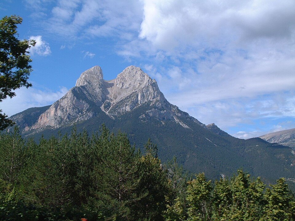
The word Pedraforca literally means "forked stone" or "stone pitchfork" in Catalan, and the name accurately describes the physiognomy of the massif: two great rocky spurs, the Pollegó Superior and the Pollegó Inferior, separated by L'Enforcadura, a breach that divides the calcareous mass and defines the unmistakable profile visible from the surrounding valleys. The highest point corresponds to the Pollegó Superior, at around 2,506 metres according to available survey values.
The Generalitat de Catalunya highlights the massif's geological and geomorphological interest as one of its main attractions. The combination of calcareous lithology, the structural arrangement of the strata and differential erosion have produced a landform that constitutes, in itself, a point of reference in the study of the eastern Pre-Pyrenees.
Protection and institutional recognition
In 1982 the Generalitat de Catalunya declared the massif a Paratge Natural d'Interès Nacional under Law 6/1982 of 6 May, a designation that preserves its landscape and geological values. The adjacent Cadí-Moixeró Natural Park shares management coordination with the Paratge by virtue of the 2004 regulations.
The Institut Cartogràfic i Geològic de Catalunya includes it in its list of the hundred most emblematic summits of Catalonia, a selection that considers the cultural and symbolic significance of each peak in addition to its orographic characteristics.
History of technical alpinism
On 30 June 1928, Lluís Estasen, Josep Puntes, Josep Rovira and Jofre Vila completed a route on the north face of the massif. The climb was recorded in the history of Catalan mountaineering as a milestone of early technical climbing in the region, at a time when the most demanding walls of the Pre-Pyrenees were beginning to be systematically explored by local climbers.
The north face of Pedraforca concentrates the most vertical terrain of the massif, and it was precisely that flank that Estasen's group chose for their historic ascent. The account of that day, recorded in the publications of the Institut d'Estudis Catalans, documents both the route taken and the composition of the rope party, precisely establishing the chronology of one of the first significant technical steps on the Catalan Pre-Pyrenean mountains.
Geographical setting
Pedraforca occupies an isolated position relative to the main alignments of the Cadí-Moixeró, which accentuates its visibility from the neighbouring municipalities of Saldes and Gósol and from wide areas of the southern valleys of the Pre-Pyrenees. This independence in the relief, expressly noted in the Generalitat's geological documentation, is one of the features that most contribute to the singular character of the massif within the natural park as a whole.