
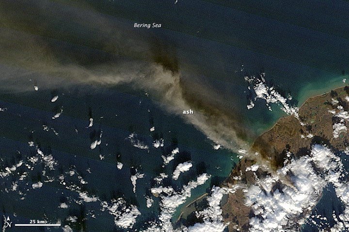
Setting and Volcanic Alignment
The Alaska Volcano Observatory places Pavlof's summit at 2,518 metres. The volcano sits near Emmons Lake Caldera and shares a northeast-trending alignment with Pavlof Sister, a distinct cone rather than a subsidiary feature. The active vents near Pavlof's summit are on its north and east flanks, above the snow and ice that mantles the upper cone.
The presence of snow and ice immediately downslope from the active vents defines the hazard environment at Pavlof. Hot eruptive material moving down those flanks can melt or entrain the snowpack, mobilising it into lahars that travel the drainage channels below.
The 2014 Eruptions: Fountains, Avalanches, and Lahars
USGS documents two eruptive episodes at Pavlof in 2014: one spanning May and June, and a second in November. During these events, lava fountains deposited accumulations of hot spatter near the summit vents. When those accumulations became unstable, they collapsed and produced hot granular avalanches that descended the flanks, melting and eroding the snow and ice on the upper cone and generating lahars that continued downslope.
Regional Disruption: Aviation and the Fishing Industry
Ash clouds from the 2014 eruptions interrupted air travel to Cold Bay and Dutch Harbor. The Alaska volcanic activity summary for 2014 records that the disruption affected fishing-industry workers and lasted several days during the June phase of activity.